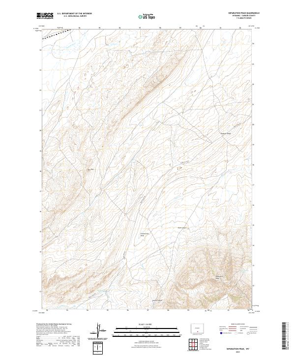
2021 Map of Separation Peak
USGS Topo · Published 2021About this map
Separation Peak dominates the southeastern horizon of this high-altitude landscape in Carbon County, which is defined by a series of dramatic geological formations and intermittent water sources. The terrain is marked by sharp features like the Red Rim and Hogback Ridge, while water management is evident at Sixteenmile Reservoir and the nearby Garza Spring. These landmarks provided essential reference points for early travelers and ranching operations in a region where reliable water was scarce.
Find a feature on this map
17 named features on this map. Tap any name to fly to it.
Don’t see what you’re looking for? This feature index may not catch every label — zoom into the map to look around manually.
Map Details
Editions of this 2021 Separation Peak Map
This is the sole edition of this map. No revisions or reprints were ever made.
Other maps of this area

1954 · Rawlins
USGS Topo · 1:250,000

1956 · Rawlins Peak
USGS Topo · 1:62,500

1956 · Bridger Pass
USGS Topo · 1:62,500

1958 · Rawlins
USGS Topo · 1:250,000

1962 · Rawlins
USGS Topo · 1:250,000

1966 · Riner
USGS Topo · 1:24,000

1966 · Fillmore Ranch
USGS Topo · 1:24,000
1966 · Antelope Spring
USGS Topo · 1:24,000

1967 · Rawlins
USGS Topo · 1:250,000
1983 · Coal Mine Ridge
USGS Topo · 1:24,000