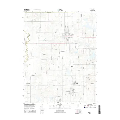
2015 Map of Sesser
USGS Topo · Published 2015About this map
Sesser serves as the central hub of this Franklin County landscape, situated amidst a dense network of country roads and small mining-era settlements. To the south and east, the map reveals the residential clusters of Valier Patch, Valier, North City, and Coello, reflecting the traditional coal-country settlement patterns of southern Illinois. The terrain is marked by modest elevations like Moores Hill and Grammer Hill, while the Little Muddy River winds along the western boundary.
Find a feature on this map
75 named features on this map. Tap any name to fly to it.
Don’t see what you’re looking for? This feature index may not catch every label — zoom into the map to look around manually.
Map Details
Editions of this 2015 Sesser Map
This is the sole edition of this map. No revisions or reprints were ever made.
Other maps of this area

1909 · West Frankfort
USGS Topo · 1:62,500

1910 · Herrin
USGS Topo · 1:62,500

1926 · Duquoin
USGS Topo · 1:62,500

1936 · Herrin
USGS Topo · 1:62,500

1939 · Ina
USGS Topo · 1:62,500

1941 · West Frankfort
USGS Topo · 1:62,500

1943 · Ina
USGS Topo · 1:62,500

1949 · Paducah
USGS Topo · 1:250,000

1950 · Paducah
USGS Topo · 1:250,000

1954 · Paducah
USGS Topo · 1:250,000