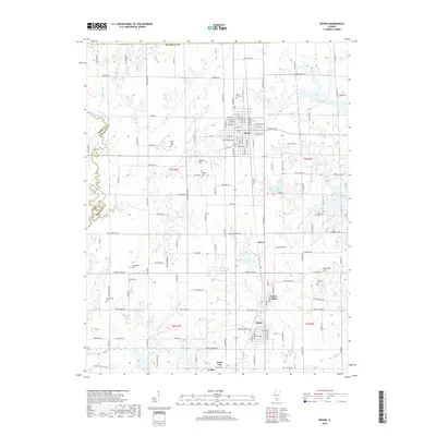
2018 Map of Sesser
USGS Topo · Published 2018About this map
Sesser and its surrounding communities in Franklin County anchor this landscape, reflecting the organized grid of the Public Land Survey System alongside modern residential growth. The area is marked by a notable distribution of family and community burial grounds, including Maple Hill Cem and Bear Point Cem, which provide essential points of reference for genealogical research. Water management is a defining characteristic of the terrain, seen in the industrial legacy of Mine Number 21 Reservoir and the recreational expanse of Christopher Lake. The transition from the rural outskirts near Meyer and Valier Patch to the more densely settled corridors of North City and Coello illustrates the historical development of these Southern Illinois coal mining and farming towns. Topography is relatively consistent, punctuated by landmarks such as Moores Hill and Grammer Hill near the banks of the Little Muddy River.
Find a feature on this map
144 named features on this map. Tap any name to fly to it.
Don’t see what you’re looking for? This feature index may not catch every label — zoom into the map to look around manually.
Map Details
Editions of this 2018 Sesser Map
This is the sole edition of this map. No revisions or reprints were ever made.
Other maps of this area

1909 · West Frankfort
USGS Topo · 1:62,500

1910 · Herrin
USGS Topo · 1:62,500

1926 · Duquoin
USGS Topo · 1:62,500

1936 · Herrin
USGS Topo · 1:62,500

1939 · Ina
USGS Topo · 1:62,500

1941 · West Frankfort
USGS Topo · 1:62,500

1943 · Ina
USGS Topo · 1:62,500

1949 · Paducah
USGS Topo · 1:250,000

1950 · Paducah
USGS Topo · 1:250,000

1954 · Paducah
USGS Topo · 1:250,000