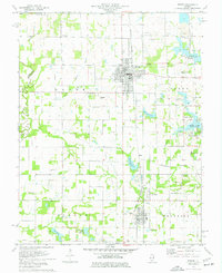
1975 Map of Sesser
USGS Topo · Published 1977About this map
The Burlington Northern railroad corridor anchors this mid-1970s landscape, connecting the industrial mining operations of the Old Ben No 21 Mine and Old Ben No 26 Mine with the established settlements of Sesser, Valier, and Valier Patch. This era marks a significant transition in the local geography as the rising waters of Rend Lake reshape the eastern boundary, flooding the lowlands of Sandusky Creek and creating new recreation zones like the Sandusky Creek West Public Use Area.
Find a feature on this map
50 named features on this map. Tap any name to fly to it.
Don’t see what you’re looking for? This feature index may not catch every label — zoom into the map to look around manually.
Map Details
Editions of this 1975 Sesser Map
This is the sole edition of this map. No revisions or reprints were ever made.
Other maps of this area

1909 · West Frankfort
USGS Topo · 1:62,500

1910 · Herrin
USGS Topo · 1:62,500

1926 · Duquoin
USGS Topo · 1:62,500

1936 · Herrin
USGS Topo · 1:62,500

1939 · Ina
USGS Topo · 1:62,500

1941 · West Frankfort
USGS Topo · 1:62,500

1943 · Ina
USGS Topo · 1:62,500

1949 · Paducah
USGS Topo · 1:250,000

1950 · Paducah
USGS Topo · 1:250,000

1954 · Paducah
USGS Topo · 1:250,000