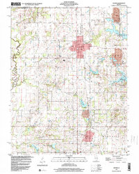
1998 Map of Sesser
USGS Topo · Published 2000About this map
The northern edge of Rend Lake dominates the eastern half of this 1990s landscape, illustrating the significant impact of the reservoir on the regional topography of Franklin County. The town of Sesser serves as the central hub, surrounded by a dense network of local history markers, including Maple Hill Cem and Wilson Sch. The legacy of the Illinois coal industry is visible through prominent landmarks like Old Ben No 21 Mine, Old Ben No 26 Mine, and the Valier Pond Mine, which are situated alongside the Burlington Northern Santa Fe railroad line.
Find a feature on this map
46 named features on this map. Tap any name to fly to it.
Don’t see what you’re looking for? This feature index may not catch every label — zoom into the map to look around manually.
Map Details
Editions of this 1998 Sesser Map
This is the sole edition of this map. No revisions or reprints were ever made.
Other maps of this area

1909 · West Frankfort
USGS Topo · 1:62,500

1910 · Herrin
USGS Topo · 1:62,500

1926 · Duquoin
USGS Topo · 1:62,500

1936 · Herrin
USGS Topo · 1:62,500

1939 · Ina
USGS Topo · 1:62,500

1941 · West Frankfort
USGS Topo · 1:62,500

1943 · Ina
USGS Topo · 1:62,500

1949 · Paducah
USGS Topo · 1:250,000

1950 · Paducah
USGS Topo · 1:250,000

1954 · Paducah
USGS Topo · 1:250,000