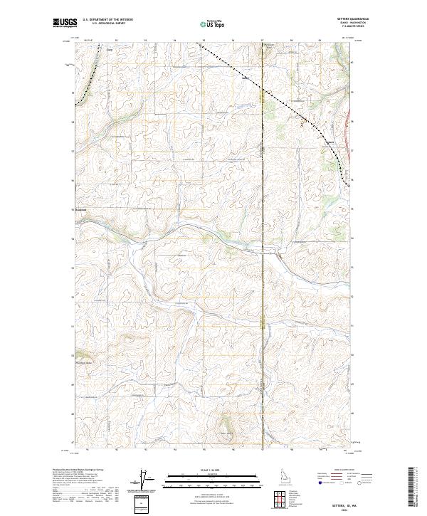
2024 Map of Setters
USGS Topo · Published 2024About this map
Rockford and Setters anchor this portion of the Idaho-Washington border, where the high plains of Spokane County meet the rising terrain of Kootenai County. The landscape is defined by its drainage systems and prominent summits, notably McGowan Butte, Morefield Butte, and Starr Butte. Watercourses like Rock Creek, Mica Creek, and the North Fork Rock Creek carve through the agricultural and timbered lands, creating a network of valleys that have historically dictated the placement of local thoroughfares. The border between the two states is marked by several crossings, including E Rockford-Idaho Rd, illustrating the close economic and social ties between these neighboring communities. Local history is etched into the landscape through small settlements like Saxby and Coey, as well as a dense grid of named rural roads such as W Missile Base Rd and S Chatcolet Rd that facilitate movement through the varied topography.
Find a feature on this map
55 named features on this map. Tap any name to fly to it.
Don’t see what you’re looking for? This feature index may not catch every label — zoom into the map to look around manually.
Map Details
Editions of this 2024 Setters Map
This is the sole edition of this map. No revisions or reprints were ever made.
Other maps of this area

1901 · Spokane
USGS Topo · 1:125,000

1903 · Oakesdale
USGS Topo · 1:125,000

1903 · Rathdrum
USGS Topo · 1:125,000

1905 · Oakesdale
USGS Topo · 1:125,000

1949 · Greenacres
USGS Topo · 1:62,500

1951 · Greenacres
USGS Topo · 1:62,500

1954 · Fairfield
USGS Topo · 1:62,500

1955 · Spokane
USGS Topo · 1:250,000

1957 · Plummer
USGS Topo · 1:62,500

1957 · Coeur D'Alene
USGS Topo · 1:62,500