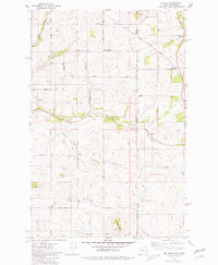
1980 Map of Setters
USGS Topo · Published 1980About this map
The Coeur d'Alene Indian Reservation occupies the eastern portion of this landscape, where the Idaho-Washington state line bisects the rolling agricultural and timber lands. The settlement of Setters sits along the Chicago Milwaukee St Paul and Pacific railroad, marked by its prominent Grain Elevators that served the local farming economy. Further north, the small siding of Saxby and the community of Rockford anchor the western reaches near the Spokane County border.
Find a feature on this map
33 named features on this map. Tap any name to fly to it.
Don’t see what you’re looking for? This feature index may not catch every label — zoom into the map to look around manually.
Map Details
Editions of this 1980 Setters Map
This is the sole edition of this map. No revisions or reprints were ever made.
Other maps of this area

1901 · Spokane
USGS Topo · 1:125,000

1903 · Oakesdale
USGS Topo · 1:125,000

1903 · Rathdrum
USGS Topo · 1:125,000

1905 · Oakesdale
USGS Topo · 1:125,000

1949 · Greenacres
USGS Topo · 1:62,500

1951 · Greenacres
USGS Topo · 1:62,500

1954 · Fairfield
USGS Topo · 1:62,500

1955 · Spokane
USGS Topo · 1:250,000

1957 · Plummer
USGS Topo · 1:62,500

1957 · Coeur D'Alene
USGS Topo · 1:62,500