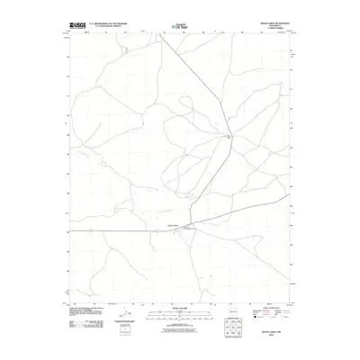
2010 Map of Seven Lakes
USGS Topo · Published 2010About this map
The Bee Burrow Archaeological District serves as a prominent landmark in this high-desert landscape of New Mexico, situated near the small settlement of Seven Lakes. This 2010 survey by the U.S. Geological Survey illustrates a sparsely populated region defined by ephemeral watercourses and ranching operations. The terrain is bisected by the Seven Lakes Wash, which drains toward the southwest, and the Kim-me-ni-oli Wash near the southern boundary. Human presence is centered around isolated points such as Ruby Wells Ranch, connected by a network of local roads and 4WD tracks that follow the natural contours of the basin. The map provides a look at land use in the Eastern Navajo Agency, where archaeological heritage and modern cattle ranching overlap.
Find a feature on this map
5 named features on this map. Tap any name to fly to it.
Don’t see what you’re looking for? This feature index may not catch every label — zoom into the map to look around manually.
Map Details
Editions of this 2010 Seven Lakes Map
This is the sole edition of this map. No revisions or reprints were ever made.
Other maps of this area

1883 · Mt. Taylor
USGS Topo · 1:250,000

1886 · Wingate
USGS Topo · 1:250,000

1886 · Mt. Taylor
USGS Topo · 1:250,000

1892 · Wingate
USGS Topo · 1:250,000

1892 · Mt. Taylor
USGS Topo · 1:250,000

1899 · Mt. Taylor
USGS Topo · 1:250,000

1954 · Gallup
USGS Topo · 1:250,000

1958 · Gallup
USGS Topo · 1:250,000

1958 · Albuquerque
USGS Topo · 1:250,000

1959 · Gallup
USGS Topo · 1:250,000