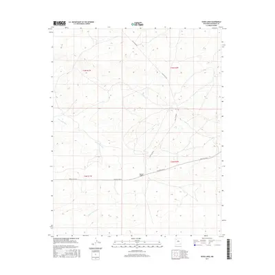
2017 Map of Seven Lakes
USGS Topo · Published 2017About this map
Seven Lakes is situated within the McKinley County portion of the Eastern Navajo Agency, serving as a focal point in a landscape defined by seasonal watercourses and desert infrastructure. The settlement sits at the intersection of local travel routes, where Navajo Svc Rte 9 meets the path of Chaco Canyon Rd. This road network facilitates movement through the high-desert terrain, connecting the small community to the broader agency lands. Drainage in the area follows the natural topography toward the northwest and southwest via Seven Lakes Wash and Kim-me-ni-oli Wash, which carve distinct paths through the township and range sections. The grid-based layout of the public land survey system is clearly visible here, overlaying the traditional drainage patterns of the basin.
Find a feature on this map
9 named features on this map. Tap any name to fly to it.
Don’t see what you’re looking for? This feature index may not catch every label — zoom into the map to look around manually.
Map Details
Editions of this 2017 Seven Lakes Map
This is the sole edition of this map. No revisions or reprints were ever made.
Other maps of this area

1883 · Mt. Taylor
USGS Topo · 1:250,000

1886 · Wingate
USGS Topo · 1:250,000

1886 · Mt. Taylor
USGS Topo · 1:250,000

1892 · Wingate
USGS Topo · 1:250,000

1892 · Mt. Taylor
USGS Topo · 1:250,000

1899 · Mt. Taylor
USGS Topo · 1:250,000

1954 · Gallup
USGS Topo · 1:250,000

1958 · Gallup
USGS Topo · 1:250,000

1958 · Albuquerque
USGS Topo · 1:250,000

1959 · Gallup
USGS Topo · 1:250,000