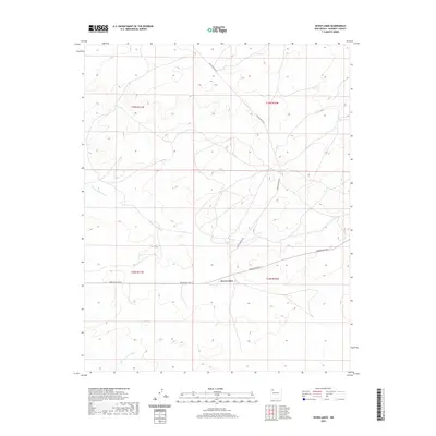
2020 Map of Seven Lakes
USGS Topo · Published 2020About this map
Seven Lakes sits at a geographic crossroads in McKinley County, defined by the seasonal drainages of the high desert plateau. This 2020 USGS survey documents the remote road network of the Eastern Navajo Agency, where the arterial Navajo Svc Rte 9 intersects with Chaco Canyon Rd. The landscape is etched by the intricate paths of Seven Lakes Wash and Kim-me-ni-oli Wash, which drain the arid reaches of Township 18 and 19 North. The map illustrates the contemporary infrastructure of this rural region, balancing traditional land management with modern transport routes. For those studying the hydrology of the San Juan Basin or tracing the evolution of Navajo Service Routes, these detailed elevation contours and watercourse paths provide essential spatial context.
Find a feature on this map
9 named features on this map. Tap any name to fly to it.
Don’t see what you’re looking for? This feature index may not catch every label — zoom into the map to look around manually.
Map Details
Editions of this 2020 Seven Lakes Map
This is the sole edition of this map. No revisions or reprints were ever made.
Other maps of this area

1883 · Mt. Taylor
USGS Topo · 1:250,000

1886 · Wingate
USGS Topo · 1:250,000

1886 · Mt. Taylor
USGS Topo · 1:250,000

1892 · Wingate
USGS Topo · 1:250,000

1892 · Mt. Taylor
USGS Topo · 1:250,000

1899 · Mt. Taylor
USGS Topo · 1:250,000

1954 · Gallup
USGS Topo · 1:250,000

1958 · Gallup
USGS Topo · 1:250,000

1958 · Albuquerque
USGS Topo · 1:250,000

1959 · Gallup
USGS Topo · 1:250,000