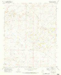
1970 Map of Seven Lakes
USGS Topo · Published 1983About this map
Seven Lakes sits as a quiet focal point in this high-desert landscape of McKinley County, as it appeared in the early 1970s. The topography is defined by the ephemeral Seven Lakes Wash, which drains the arid basin where isolated ranching and resource extraction left their mark. Scattered Drill Holes and the Togie Well indicate a period of active exploratory drilling, perhaps searching for oil or water in this dry expanse. Local habitation is sparse, centered on small outposts like the Ruby Wells Ranch. Of particular interest to those studying the long human history of the region are the unnamed Ruins located north of the wash, pointing toward older occupations that preceded the ranching era. The layout reflects a landscape where water management and mineral rights were the primary drivers of human presence.
Find a feature on this map
10 named features on this map. Tap any name to fly to it.
Don’t see what you’re looking for? This feature index may not catch every label — zoom into the map to look around manually.
Map Details
Editions of this 1970 Seven Lakes Map
This is the sole edition of this map. No revisions or reprints were ever made.
Other maps of this area

1883 · Mt. Taylor
USGS Topo · 1:250,000

1886 · Wingate
USGS Topo · 1:250,000

1886 · Mt. Taylor
USGS Topo · 1:250,000

1892 · Wingate
USGS Topo · 1:250,000

1892 · Mt. Taylor
USGS Topo · 1:250,000

1899 · Mt. Taylor
USGS Topo · 1:250,000

1954 · Gallup
USGS Topo · 1:250,000

1958 · Gallup
USGS Topo · 1:250,000

1958 · Albuquerque
USGS Topo · 1:250,000

1959 · Gallup
USGS Topo · 1:250,000