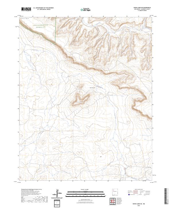
2023 Map of Seven Lakes NE
USGS Topo · Published 2023About this map
Chaco Culture National Historical Park anchors the northwestern corner of this McKinley County landscape, where the ancient topography of Chaco Canyon begins to emerge from the surrounding high desert. The terrain is defined by dramatic elevation changes, notably at Chaco Mesa and its western extension, W Chaco Mesa. These landforms overlook an intricate drainage system where the seasonal waters of Chaco Wash and Fajada Wash have carved deep into the earth.
Find a feature on this map
12 named features on this map. Tap any name to fly to it.
Don’t see what you’re looking for? This feature index may not catch every label — zoom into the map to look around manually.
Map Details
Editions of this 2023 Seven Lakes NE Map
This is the sole edition of this map. No revisions or reprints were ever made.
Other maps of this area

1883 · Mt. Taylor
USGS Topo · 1:250,000

1886 · Mt. Taylor
USGS Topo · 1:250,000

1889 · Largo
USGS Topo · 1:250,000

1892 · Mt. Taylor
USGS Topo · 1:250,000

1895 · Largo
USGS Topo · 1:250,000

1899 · Mt. Taylor
USGS Topo · 1:250,000

1954 · Aztec
USGS Topo · 1:250,000

1958 · Aztec
USGS Topo · 1:250,000

1958 · Albuquerque
USGS Topo · 1:250,000

1961 · Whitehorse
USGS Topo · 1:24,000