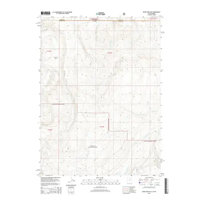
2014 Map of Seven Tree Flat
USGS Topo · Published 2014About this map
The Seven Tree Flat plateau occupies the northwestern corner of this 2014 survey, where the high-elevation terrain of Summit County, Utah, meets the Uinta County, Wyoming, border. This intersection of state lines is defined by a dense network of mountain drainages, including the headwaters of Chalk Cr and Yellow Cr. To the south and east, the landscape transitions into the protected wilderness of the Wasatch National Forest, where the topography becomes increasingly steep and complex. Modern accessibility is limited to a few arterial routes such as Chalk Creek Rd and Whitney Rd, reflecting the remote and undeveloped character of the High Uintas. Notable waterways such as the W Fork Bear River and Deer Cr carve deep through the forest, illustrating the critical role this region plays in the watershed of the northern Wasatch Range.
Find a feature on this map
20 named features on this map. Tap any name to fly to it.
Don’t see what you’re looking for? This feature index may not catch every label — zoom into the map to look around manually.
Map Details
Editions of this 2014 Seven Tree Flat Map
This is the sole edition of this map. No revisions or reprints were ever made.
Other maps of this area

1885 · Salt Lake
USGS Topo · 1:250,000

1885 · Uinta
USGS Topo · 1:250,000

1900 · Coalville
USGS Topo · 1:125,000

1901 · Hayden Peak
USGS Topo · 1:125,000

1903 · Hayden Peak
USGS Topo · 1:125,000

1903 · Coalville
USGS Topo · 1:125,000

1954 · Salt Lake City
USGS Topo · 1:250,000

1954 · Ogden
USGS Topo · 1:250,000

1958 · Ogden
USGS Topo · 1:250,000

1958 · Salt Lake City
USGS Topo · 1:250,000