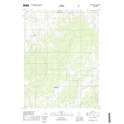
2020 Map of Seven Tree Flat
USGS Topo · Published 2020About this map
Wasatch National Forest dominates this landscape along the border of Utah and Wyoming. The map details a high-elevation environment defined by a dense network of drainage systems, including the W Fork Bear River and Mill City Cr in the southeast corner. The topography is marked by significant elevation changes, with numerous named waterways like Chalk Cr, Yellow Cr, and Florence Cr carving through the terrain. Evidence of human passage and management is limited to specific corridors, most notably the Whitney Rd and the eponymous Seven Tree Flat in the northwest. This 2020 survey illustrates the hydrological complexity of the region, showing how smaller tributaries such as Humpy Cr and Deer Cr feed the larger river systems within the protected forest boundaries.
Find a feature on this map
14 named features on this map. Tap any name to fly to it.
Don’t see what you’re looking for? This feature index may not catch every label — zoom into the map to look around manually.
Map Details
Editions of this 2020 Seven Tree Flat Map
This is the sole edition of this map. No revisions or reprints were ever made.
Other maps of this area

1885 · Salt Lake
USGS Topo · 1:250,000

1885 · Uinta
USGS Topo · 1:250,000

1900 · Coalville
USGS Topo · 1:125,000

1901 · Hayden Peak
USGS Topo · 1:125,000

1903 · Hayden Peak
USGS Topo · 1:125,000

1903 · Coalville
USGS Topo · 1:125,000

1954 · Salt Lake City
USGS Topo · 1:250,000

1954 · Ogden
USGS Topo · 1:250,000

1958 · Ogden
USGS Topo · 1:250,000

1958 · Salt Lake City
USGS Topo · 1:250,000