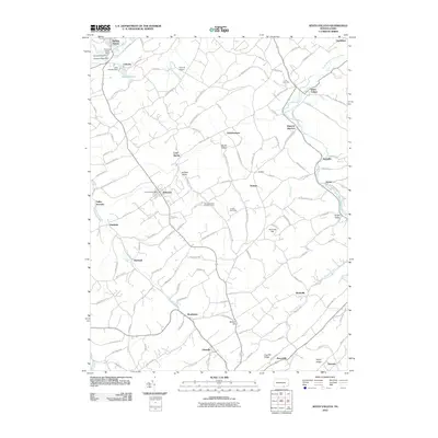
2010 Map of Seven Valleys
USGS Topo · Published 2010About this map
Codorus Creek and its many tributaries define the landscape of south-central Pennsylvania on this 2010 survey. The settlement pattern shows a high density of small villages and junctions, including Seven Valleys, Jefferson, and Glenville, connected by a network of winding roads like Zeiglers Church Rd and Walters Hatchery Rd. Notable for researchers are the specialized agricultural and local landmarks, such as Meadow Valley Breeder Farms, Hunter Glen Farm, and even a Pet Cemetery north of Hanover Junction. The terrain is characterized by named ridges and valleys, including Saubel Hill, Huntrick Hill, and Krebs Valley, while the B and B Airport and Spring Grove Dam indicate more modern infrastructural developments in this rural landscape.
Find a feature on this map
132 named features on this map. Tap any name to fly to it.
Don’t see what you’re looking for? This feature index may not catch every label — zoom into the map to look around manually.
Map Details
Editions of this 2010 Seven Valleys Map
This is the sole edition of this map. No revisions or reprints were ever made.
Other maps of this area

1900 · Parkton
USGS Topo · 1:62,500

1902 · Parkton
USGS Topo · 1:62,500

1905 · Westminster
USGS Topo · 1:62,500

1908 · York
USGS Topo · 1:62,500

1910 · York
USGS Topo · 1:62,500

1920 · Hanover
USGS Topo · 1:62,500

1922 · Hanover
USGS Topo · 1:62,500

1944 · New Freedom
USGS Topo · 1:31,680

1944 · Manchester
USGS Topo · 1:31,680

1944 · Lineboro
USGS Topo · 1:31,680