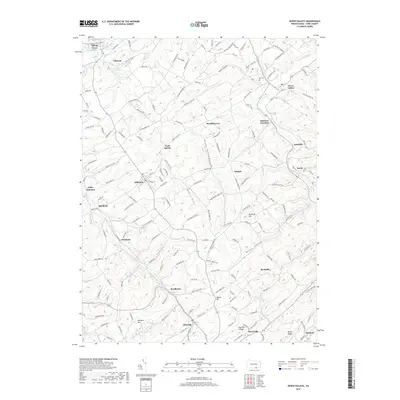
2019 Map of Seven Valleys
USGS Topo · Published 2019About this map
Seven Valleys and Hanover Junction anchor this landscape in York County, where the intricate network of the South Branch Codorus Creek and its tributaries like Fishel Cr and Cherry Run carve out a series of valleys. The geography of the region is defined by these waterways and the ridges between them, such as Dug Hill Ridge and Rocky Ridge. The map illustrates a dense collection of small communities and rural intersections, including Jefferson, Sinsheim, and Brodbecks, each connected by a winding road system that reflects the area's long-standing agricultural and local trade patterns. Researchers can observe the transition from the more developed area of Spring Grove in the northwest to the rugged topography of Buffalo Valley and Krebs Valley. Notable local landmarks like the Pet Cem near Seven Valleys and Lake Lehman provide specific points of interest for genealogists and local historians tracing family connections to these specific corners of Pennsylvania.
Find a feature on this map
170 named features on this map. Tap any name to fly to it.
Don’t see what you’re looking for? This feature index may not catch every label — zoom into the map to look around manually.
Map Details
Editions of this 2019 Seven Valleys Map
This is the sole edition of this map. No revisions or reprints were ever made.
Other maps of this area

1900 · Parkton
USGS Topo · 1:62,500

1902 · Parkton
USGS Topo · 1:62,500

1905 · Westminster
USGS Topo · 1:62,500

1908 · York
USGS Topo · 1:62,500

1910 · York
USGS Topo · 1:62,500

1920 · Hanover
USGS Topo · 1:62,500

1922 · Hanover
USGS Topo · 1:62,500

1944 · New Freedom
USGS Topo · 1:31,680

1944 · Manchester
USGS Topo · 1:31,680

1944 · Lineboro
USGS Topo · 1:31,680