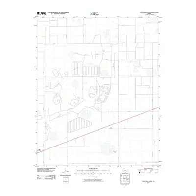
2010 Map of Sevenmile Basin
USGS Topo · Published 2010About this map
Sevenmile Basin defines the central topography of this Texas High Plains landscape, where the flat horizon is broken by the depressions of ephemeral water bodies like Pantex Lake. The settlement of Saint Francis anchors the southwest corner of the map, while the rural character of the region is further evidenced by the isolated Liberty Cemetery. The land is organized by a strict grid of county roads and farm-to-market routes, including Fm 2373 and Fm Road 293, which intersect at various points across the prairie. The presence of several large industrial or specialized facilities, indicated by complex road networks such as Washington Dr and Pershing Dr, suggests a landscape shaped by more than just agriculture, reflecting the unique strategic and industrial history of this part of Carson County.
Find a feature on this map
27 named features on this map. Tap any name to fly to it.
Don’t see what you’re looking for? This feature index may not catch every label — zoom into the map to look around manually.
Map Details
Editions of this 2010 Sevenmile Basin Map
This is the sole edition of this map. No revisions or reprints were ever made.
Other maps of this area

1953 · Mayer
USGS Topo · 1:24,000

1953 · Pomeroy
USGS Topo · 1:24,000

1953 · Berry Sand Draw
USGS Topo · 1:24,000

1953 · Sevenmile Basin
USGS Topo · 1:24,000

1954 · Amarillo
USGS Topo · 1:250,000

1956 · Washburn
USGS Topo · 1:24,000

1956 · Pullman
USGS Topo · 1:24,000

1958 · Amarillo
USGS Topo · 1:250,000

1960 · Claude
USGS Topo · 1:62,500

1965 · Abell
USGS Topo · 1:24,000