
1953 Map of Pomeroy
USGS Topo · Published 1954About this map
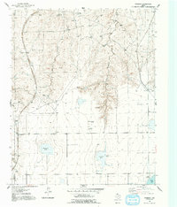
The High Plains landscape of the Texas Panhandle is defined here by the drainage of West Fork Antelope Creek and East Fork Antelope Creek as they carve through the plateau. This 1950s survey captures a transition in the local economy, where traditional ranching operations like the Deal Ranch and Williams Ranch coexist with emerging mid-century infrastructure. The arrival of communication technology is marked by the Radio Towers (KGNC) and Transmitter (KGNC) near the center of the sheet. Transportation is anchored by two major rail lines: the Chicago Rock Island and Pacific running along the western edge through Masterson, and the Panhandle and Santa Fe passing through Pomeroy to the east. The presence of several large catchment basins, including Rockwell Lake, Icehouse Lake, and Pantex Lake, highlights the critical importance of water management in this semi-arid ranching country.
Find a feature on this map
15 named features on this map. Tap any name to fly to it.
Don’t see what you’re looking for? This feature index may not catch every label — zoom into the map to look around manually.
Map Details
Editions of this 1953 Pomeroy Map
2 editions found
Other maps of this area

1939 · Sanford
USGS Topo · 1:62,500

1953 · Alibates Ranch
USGS Topo · 1:24,000

1953 · Deal
USGS Topo · 1:24,000

1953 · Mayer
USGS Topo · 1:24,000

1953 · McBride
USGS Topo · 1:24,000

1953 · Berry Sand Draw
USGS Topo · 1:24,000

1953 · Sevenmile Basin
USGS Topo · 1:24,000

1954 · Amarillo
USGS Topo · 1:250,000

1958 · Amarillo
USGS Topo · 1:250,000

1965 · Abell
USGS Topo · 1:24,000