
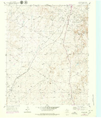
1953 Map of McBride
USGS Topo · Published 1955About this map
Industrial infrastructure and ranching heritage intersect in this survey of the Texas Panhandle, where the Burnett Oil Field dominates the high plains landscape. The extraction economy is clearly defined by an extensive network of aqueducts, pipelines, and gas wells that flank Rock Creek. Settlement patterns are tied directly to these resources, evidenced by worker housing at Burnett Camp and Hillard.
Find a feature on this map
19 named features on this map. Tap any name to fly to it.
Don’t see what you’re looking for? This feature index may not catch every label — zoom into the map to look around manually.
Map Details
Editions of this 1953 McBride Map
2 editions found
Other maps of this area

1939 · Sanford
USGS Topo · 1:62,500

1953 · Sanford
USGS Topo · 1:24,000

1953 · Deal
USGS Topo · 1:24,000

1953 · Borger SE
USGS Topo · 1:24,000

1953 · Pomeroy
USGS Topo · 1:24,000

1953 · Phillips
USGS Topo · 1:24,000

1953 · Borger
USGS Topo · 1:24,000

1954 · Amarillo
USGS Topo · 1:250,000

1958 · Amarillo
USGS Topo · 1:250,000

1965 · Abell
USGS Topo · 1:24,000