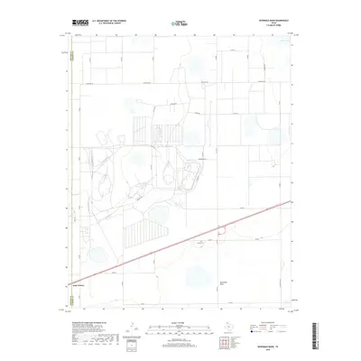
2019 Map of Sevenmile Basin
USGS Topo · Published 2019About this map
Saint Francis anchors the southwestern corner of this survey, marking a pocket of settlement near the Potter and Carson County line. The landscape is defined by the broad topographic depression of the Sevenmile Basin, a natural feature that influences the local drainage and road network. Evidence of long-standing community ties can be found at the Liberty Cem, which sits along Co Rd 7. This 2019 survey shows a heavy reliance on a grid of county roads and farm-to-market routes like Fm 2373 and Ranch Rd 293 to navigate the wide-open terrain. To the northeast, the presence of Pantex Lake provides a rare water feature in an otherwise arid expanse dominated by large-scale infrastructure and industrial development near Pershing Dr and Washington Dr.
Find a feature on this map
31 named features on this map. Tap any name to fly to it.
Don’t see what you’re looking for? This feature index may not catch every label — zoom into the map to look around manually.
Map Details
Editions of this 2019 Sevenmile Basin Map
This is the sole edition of this map. No revisions or reprints were ever made.
Other maps of this area

1953 · Mayer
USGS Topo · 1:24,000

1953 · Pomeroy
USGS Topo · 1:24,000

1953 · Berry Sand Draw
USGS Topo · 1:24,000

1953 · Sevenmile Basin
USGS Topo · 1:24,000

1954 · Amarillo
USGS Topo · 1:250,000

1956 · Washburn
USGS Topo · 1:24,000

1956 · Pullman
USGS Topo · 1:24,000

1958 · Amarillo
USGS Topo · 1:250,000

1960 · Claude
USGS Topo · 1:62,500

1965 · Abell
USGS Topo · 1:24,000