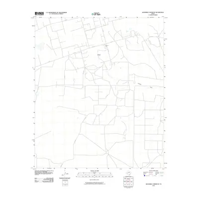
2010 Map of Sevenmile Corner SE
USGS Topo · Published 2010About this map
Benedum Oil Field defines the industrial footprint of this West Texas landscape, where the grid-like extraction network meets the natural topography of the Permian Basin. The infrastructure of the petroleum industry is central to the area's development, evidenced by the presence of Benedum Camp and a dense system of service roads including Fm 1555 and Fm 2594. These routes connect remote work sites to regional hubs, illustrating the 21st-century state of energy production in Reagan County.
Find a feature on this map
12 named features on this map. Tap any name to fly to it.
Don’t see what you’re looking for? This feature index may not catch every label — zoom into the map to look around manually.
Map Details
Editions of this 2010 Sevenmile Corner SE Map
This is the sole edition of this map. No revisions or reprints were ever made.
Other maps of this area

1928 · Rankin
USGS Topo · 1:125,000

1954 · San Angelo
USGS Topo · 1:250,000

1958 · San Angelo
USGS Topo · 1:250,000

1965 · San Angelo
USGS Topo · 1:250,000

1970 · Sevenmile Corner NE
USGS Topo · 1:24,000

1970 · Stiles NW
USGS Topo · 1:24,000

1970 · Lindsey Ranch
USGS Topo · 1:24,000

1970 · Sevenmile Corner SE
USGS Topo · 1:24,000

1970 · Sevenmile Corner
USGS Topo · 1:24,000
1970 · Rankin NE
USGS Topo · 1:24,000