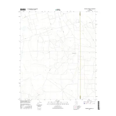
2016 Map of Sevenmile Corner SE
USGS Topo · Published 2016About this map
Centralia Draw winds through the high plains of the Permian Basin, defining the drainage patterns of this rural landscape where Reagan and Upton counties meet. The terrain is marked by a network of ranch-to-market roads and county lines, reflecting the organized division of West Texas land for agriculture and resource extraction. The boundary between Upton and Reagan Counties runs vertically through the eastern portion of the sheet, a significant marker for local history and property research. Transportation is anchored by Fm 1555 and Fm 2594, which connect the isolated homesteads and industrial sites. Other local arteries like Co Rd 255 and Elliott Rd provide a clear view of the rural infrastructure as it existed in the mid-2010s.
Find a feature on this map
11 named features on this map. Tap any name to fly to it.
Don’t see what you’re looking for? This feature index may not catch every label — zoom into the map to look around manually.
Map Details
Editions of this 2016 Sevenmile Corner SE Map
This is the sole edition of this map. No revisions or reprints were ever made.
Other maps of this area

1928 · Rankin
USGS Topo · 1:125,000

1954 · San Angelo
USGS Topo · 1:250,000

1958 · San Angelo
USGS Topo · 1:250,000

1965 · San Angelo
USGS Topo · 1:250,000

1970 · Sevenmile Corner NE
USGS Topo · 1:24,000

1970 · Stiles NW
USGS Topo · 1:24,000

1970 · Lindsey Ranch
USGS Topo · 1:24,000

1970 · Sevenmile Corner SE
USGS Topo · 1:24,000

1970 · Sevenmile Corner
USGS Topo · 1:24,000
1970 · Rankin NE
USGS Topo · 1:24,000