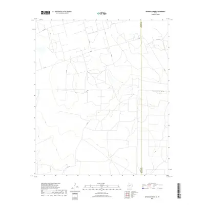
2019 Map of Sevenmile Corner SE
USGS Topo · Published 2019About this map
Centralia Draw winds across the arid landscape of West Texas, serving as the primary drainage feature for this segment of the Permian Basin. This 2019 survey captures the area at the boundary of Upton and Reagan Counties, where the geography is defined by a sparse but organized network of rural infrastructure. The landscape is dominated by a grid of county roads and farm-to-market routes, including Fm 1555 and Fm 2594, which facilitate the movement of local industry and agriculture through this high-plains environment. The map provides a look at modern land use, showing how named thoroughfares like Co Rd 255 and Elliott Rd intersect with the natural topography of the draw, reflecting the persistence of ranching and resource extraction in this part of the state.
Find a feature on this map
11 named features on this map. Tap any name to fly to it.
Don’t see what you’re looking for? This feature index may not catch every label — zoom into the map to look around manually.
Map Details
Editions of this 2019 Sevenmile Corner SE Map
This is the sole edition of this map. No revisions or reprints were ever made.
Other maps of this area

1928 · Rankin
USGS Topo · 1:125,000

1954 · San Angelo
USGS Topo · 1:250,000

1958 · San Angelo
USGS Topo · 1:250,000

1965 · San Angelo
USGS Topo · 1:250,000

1970 · Sevenmile Corner NE
USGS Topo · 1:24,000

1970 · Stiles NW
USGS Topo · 1:24,000

1970 · Lindsey Ranch
USGS Topo · 1:24,000

1970 · Sevenmile Corner SE
USGS Topo · 1:24,000

1970 · Sevenmile Corner
USGS Topo · 1:24,000
1970 · Rankin NE
USGS Topo · 1:24,000