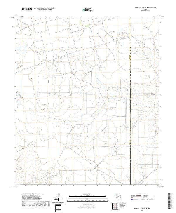
2022 Map of Sevenmile Corner SE
USGS Topo · Published 2022About this map
Centralia Draw meanders across this West Texas landscape, defining the local drainage patterns in a region where water and terrain are closely linked. This area, spanning the border of Upton and Reagan counties, is characterized by its organized grid of rural infrastructure and transportation routes. Modern county roads such as Co Rd 255 and Co Rd 230 serve the expansive ranchlands and oil-producing territories that dominate this portion of the Permian Basin. The intersection of Fm 1555 and Fm 2594 provides a central hub for the localized movement of goods and equipment through the plains. The map reveals the precise county line and the distribution of property access through named thoroughfares like Elliott Rd, reflecting the continued importance of land divisions and surface management in this sparsely populated but economically vital Texas interior.
Find a feature on this map
11 named features on this map. Tap any name to fly to it.
Don’t see what you’re looking for? This feature index may not catch every label — zoom into the map to look around manually.
Map Details
Editions of this 2022 Sevenmile Corner SE Map
This is the sole edition of this map. No revisions or reprints were ever made.
Other maps of this area

1928 · Rankin
USGS Topo · 1:125,000

1954 · San Angelo
USGS Topo · 1:250,000

1958 · San Angelo
USGS Topo · 1:250,000

1965 · San Angelo
USGS Topo · 1:250,000

1970 · Sevenmile Corner NE
USGS Topo · 1:24,000

1970 · Stiles NW
USGS Topo · 1:24,000

1970 · Lindsey Ranch
USGS Topo · 1:24,000

1970 · Sevenmile Corner SE
USGS Topo · 1:24,000

1970 · Sevenmile Corner
USGS Topo · 1:24,000
1970 · Rankin NE
USGS Topo · 1:24,000