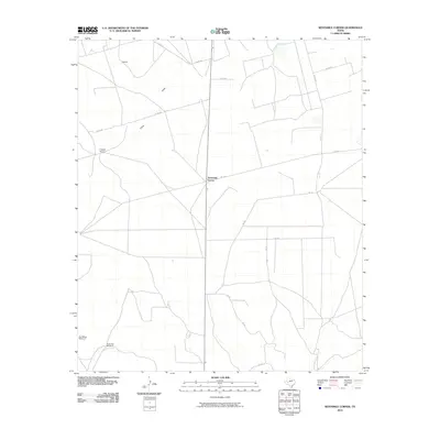
2010 Map of Sevenmile Corner
USGS Topo · Published 2010About this map
Sevenmile Corner serves as the central junction for this stretch of the West Texas landscape, where the intersection of State Road 349 and Fm 1555 anchors the surrounding ranching country. The terrain is characterized by broad stretches of Upland and the winding path of China Draw, which cuts across the northern section of the map near Co Rd 105. This 2010 survey illustrates the functional infrastructure of the region, emphasizing a grid of county roads that connect isolated operations and landmarks. Noteworthy markers of local utility and history include the Joe Bailey Windmill and Duke Hill Windmill to the southwest, while the presence of the Tippett Ranch further north highlights the enduring agricultural character of Upton County. The map provides a clear look at the sparse but vital network of roads and water-related infrastructure essential for life in this arid region.
Find a feature on this map
13 named features on this map. Tap any name to fly to it.
Don’t see what you’re looking for? This feature index may not catch every label — zoom into the map to look around manually.
Map Details
Editions of this 2010 Sevenmile Corner Map
This is the sole edition of this map. No revisions or reprints were ever made.
Other maps of this area

1928 · Crane
USGS Topo · 1:125,000

1928 · Rankin
USGS Topo · 1:125,000

1954 · Pecos
USGS Topo · 1:250,000

1954 · San Angelo
USGS Topo · 1:250,000

1957 · Pecos
USGS Topo · 1:250,000

1958 · San Angelo
USGS Topo · 1:250,000

1965 · San Angelo
USGS Topo · 1:250,000

1970 · Sevenmile Corner NE
USGS Topo · 1:24,000

1970 · Lindsey Ranch
USGS Topo · 1:24,000

1970 · Sevenmile Corner SE
USGS Topo · 1:24,000