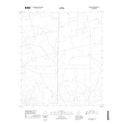
2019 Map of Sevenmile Corner
USGS Topo · Published 2019About this map
China Draw winds through the heart of this West Texas landscape, serving as a primary topographic feature in an area defined by its expansive ranching and oil-field infrastructure. This 2019 survey of Upton County illustrates a sparse but functional network of rural roads that facilitate movement across the Permian Basin's high plains. A central north-south corridor is flanked by routes such as Co Rd 107 and Co Rd 105, while Fm 1555 cuts horizontally across the sheet. The map documents the layout of modern land management and energy development, where the intersecting lines of Co Rd 106 and Rd 102 show the methodical division of territory. Researchers will find a precise record of the contemporary landscape, showing how the natural drainage of the draw contrasts with the rigid geometry of county road systems and local connectors.
Find a feature on this map
9 named features on this map. Tap any name to fly to it.
Don’t see what you’re looking for? This feature index may not catch every label — zoom into the map to look around manually.
Map Details
Editions of this 2019 Sevenmile Corner Map
This is the sole edition of this map. No revisions or reprints were ever made.
Other maps of this area

1928 · Crane
USGS Topo · 1:125,000

1928 · Rankin
USGS Topo · 1:125,000

1954 · Pecos
USGS Topo · 1:250,000

1954 · San Angelo
USGS Topo · 1:250,000

1957 · Pecos
USGS Topo · 1:250,000

1958 · San Angelo
USGS Topo · 1:250,000

1965 · San Angelo
USGS Topo · 1:250,000

1970 · Sevenmile Corner NE
USGS Topo · 1:24,000

1970 · Lindsey Ranch
USGS Topo · 1:24,000

1970 · Sevenmile Corner SE
USGS Topo · 1:24,000