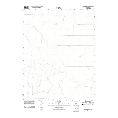
2010 Map of Sevenmile Ranch
USGS Topo · Published 2010About this map
Sevenmile Ranch sits at the heart of this high plains landscape in eastern Colorado, where the drainage patterns of the South Fork Republican River define the local topography. This 2010 survey illustrates the remote ranching infrastructure of Lincoln County, characterized by a grid-like network of rural transit lines including County Rd-38 and County Rd 2W. The hydrology of the region is dominated by ephemeral and permanent watercourses like Sevenmile Creek, West Sevenmile Creek, and Buffalo Creek, which carve distinct paths across the open country. These waterways were essential for sustaining the livestock operations that have long been the backbone of the area's economy. The map provides a clear record of property access and water resources at a time when the region's agricultural footprint remained largely consistent with historical ranching traditions.
Find a feature on this map
15 named features on this map. Tap any name to fly to it.
Don’t see what you’re looking for? This feature index may not catch every label — zoom into the map to look around manually.
Map Details
Editions of this 2010 Sevenmile Ranch Map
This is the sole edition of this map. No revisions or reprints were ever made.
Other maps of this area

1954 · Limon
USGS Topo · 1:250,000

1957 · Limon
USGS Topo · 1:250,000

1958 · Limon
USGS Topo · 1:250,000

1978 · Clifford
USGS Topo · 1:24,000

1978 · Hugo 4 NW
USGS Topo · 1:24,000

1979 · Sevenmile Ranch
USGS Topo · 1:24,000
1979 · Clifford
USGS Topo · 1:24,000

1979 · Arriba
USGS Topo · 1:24,000

1979 · Flagler SW
USGS Topo · 1:24,000

1979 · Genoa East
USGS Topo · 1:24,000