
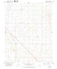
1978 Map of Hugo 4 NW
USGS Topo · Published 1978About this map
The South Fork Republican River winds through this High Plains landscape, which is defined by its deep drainages and agricultural infrastructure in the late 1970s. This survey focuses on the boundary between Lincoln Co and Kit Carson Co, illustrating the remote ranching and farming character of eastern Colorado. Water resources are central to the terrain, marked by seasonal flows like Duck Creek and several isolated Springs that supported local livestock. The map provides a clear record of man-made improvements across the open range, including several Tanks and clusters of Storage Bins, reflecting the post-war development of industrial agriculture. This topography, based on aerial photography from 1973, captures the quiet transition of the prairie before modern center-pivot irrigation became more dominant in the region.
Find a feature on this map
6 named features on this map. Tap any name to fly to it.
Don’t see what you’re looking for? This feature index may not catch every label — zoom into the map to look around manually.
Map Details
Editions of this 1978 Hugo 4 NW Map
This is the sole edition of this map. No revisions or reprints were ever made.
Other maps of this area

1954 · Limon
USGS Topo · 1:250,000

1957 · Limon
USGS Topo · 1:250,000

1958 · Limon
USGS Topo · 1:250,000

1978 · Clifford
USGS Topo · 1:24,000

1979 · Sevenmile Ranch
USGS Topo · 1:24,000
1979 · Clifford
USGS Topo · 1:24,000

1979 · Hugo 4 NE
USGS Topo · 1:24,000

1979 · Arriba
USGS Topo · 1:24,000

1979 · Flagler SW
USGS Topo · 1:24,000

1979 · Flagler
USGS Topo · 1:24,000