
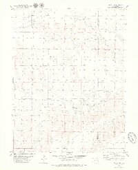
1979 Map of Flagler SW
USGS Topo · Published 1979About this map
The Chicago Rock Island and Pacific railroad forms the structural heart of this High Plains landscape, cutting a straight east-west line across the prairie. This 1970s survey captures the region as a sparsely populated agricultural expanse defined by long-distance infrastructure and intermittent watercourses. The boundary between Lincoln Co Kit Carson Co runs vertically through the eastern portion of the map, marking a legal division in an otherwise open terrain. Drainage patterns are defined by the winding paths of Buffalo Creek and Duck Creek, which provide the primary topographical relief against the flat horizons. Aside from the heavy rail line, the presence of a significant Pipeline and scattered industrial or agricultural Wells suggests a landscape dedicated to resource extraction and transit rather than concentrated settlement.
Find a feature on this map
7 named features on this map. Tap any name to fly to it.
Don’t see what you’re looking for? This feature index may not catch every label — zoom into the map to look around manually.
Map Details
Editions of this 1979 Flagler SW Map
This is the sole edition of this map. No revisions or reprints were ever made.
Other maps of this area

1954 · Limon
USGS Topo · 1:250,000

1957 · Limon
USGS Topo · 1:250,000

1958 · Limon
USGS Topo · 1:250,000

1978 · Hugo 4 NW
USGS Topo · 1:24,000

1979 · Sevenmile Ranch
USGS Topo · 1:24,000

1979 · Hugo 4 NE
USGS Topo · 1:24,000

1979 · Arriba
USGS Topo · 1:24,000

1979 · Flagler NW
USGS Topo · 1:24,000

1979 · Flagler
USGS Topo · 1:24,000
1979 · Hugo 4 NW
USGS Topo · 1:24,000