
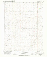
1979 Map of Flagler NW
USGS Topo · Published 1979About this map
Arikaree River and Hell Creek dominate this 1970s landscape on the High Plains of eastern Colorado. This corner of Lincoln Co and Kit Carson Co is characterized by its wide, sandy drainage basins and a regular grid of section lines that define the region's agricultural layout. Unlike more mountainous parts of the state, the land here is marked by subtle shifts in elevation and several scattered water wells, highlighting the importance of groundwater for survival and ranching in this semi-arid environment. The lack of concentrated settlements or major infrastructure suggests a sparsely populated area focused on grazing or dryland farming, where the natural watercourses provide the primary geographical orientation across the open range.
Find a feature on this map
4 named features on this map. Tap any name to fly to it.
Don’t see what you’re looking for? This feature index may not catch every label — zoom into the map to look around manually.
Map Details
Editions of this 1979 Flagler NW Map
This is the sole edition of this map. No revisions or reprints were ever made.
Other maps of this area

1954 · Limon
USGS Topo · 1:250,000

1957 · Limon
USGS Topo · 1:250,000

1958 · Limon
USGS Topo · 1:250,000

1973 · Shaw
USGS Topo · 1:24,000

1977 · Thurman
USGS Topo · 1:24,000

1977 · Anton SE
USGS Topo · 1:24,000

1979 · Arriba
USGS Topo · 1:24,000

1979 · Flagler SW
USGS Topo · 1:24,000

1979 · Flagler
USGS Topo · 1:24,000
1979 · Arriba NE
USGS Topo · 1:24,000