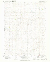
1979 Map of Arriba NE
USGS Topo · Published 1979About this map
The Arikaree River and its meandering drainage network define this high plains landscape in eastern Colorado. The 1979 survey reveals a rural Lincoln County environment where water sources like Dugout Creek and Hell Creek dictate the layout of the land. Human activity is focused on agricultural and industrial infrastructure, evidenced by several Gravel Pits and scattered Wells throughout the sections. Community life is anchored by Bethel Ch, while private aviation is noted by the inclusion of localized Landing Strips. The topography is characterized by the broad valley of the river and the carved paths of Hackberry Creek and Arikaree Creek as they converge in this sparsely populated region of the state.
Find a feature on this map
14 named features on this map. Tap any name to fly to it.
Don’t see what you’re looking for? This feature index may not catch every label — zoom into the map to look around manually.
Map Details
Editions of this 1979 Arriba NE Map
This is the sole edition of this map. No revisions or reprints were ever made.
Other maps of this area

1954 · Limon
USGS Topo · 1:250,000

1957 · Limon
USGS Topo · 1:250,000

1958 · Limon
USGS Topo · 1:250,000

1973 · Lindon SW
USGS Topo · 1:24,000

1973 · Shaw
USGS Topo · 1:24,000

1977 · Thurman
USGS Topo · 1:24,000

1979 · Arriba NW
USGS Topo · 1:24,000

1979 · Arriba
USGS Topo · 1:24,000

1979 · Flagler SW
USGS Topo · 1:24,000

1979 · Genoa East
USGS Topo · 1:24,000