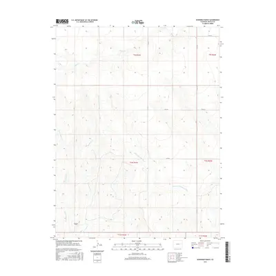
2016 Map of Sevenmile Ranch
USGS Topo · Published 2016About this map
Sevenmile Ranch serves as the primary named landmark in this expanse of the Colorado High Plains, situated at the confluence of several seasonal drainages. The landscape is defined by the winding course of the South Fork Republican River, which carves a path through the northeastern plains alongside smaller tributaries such as Buffalo Cr and Coon Cr. The terrain is marked by the distinct draws of Sevenmile Cr and its western branch, W Sevenmile Cr.
Find a feature on this map
19 named features on this map. Tap any name to fly to it.
Don’t see what you’re looking for? This feature index may not catch every label — zoom into the map to look around manually.
Map Details
Editions of this 2016 Sevenmile Ranch Map
This is the sole edition of this map. No revisions or reprints were ever made.
Other maps of this area

1954 · Limon
USGS Topo · 1:250,000

1957 · Limon
USGS Topo · 1:250,000

1958 · Limon
USGS Topo · 1:250,000

1978 · Clifford
USGS Topo · 1:24,000

1978 · Hugo 4 NW
USGS Topo · 1:24,000

1979 · Sevenmile Ranch
USGS Topo · 1:24,000
1979 · Clifford
USGS Topo · 1:24,000

1979 · Arriba
USGS Topo · 1:24,000

1979 · Flagler SW
USGS Topo · 1:24,000

1979 · Genoa East
USGS Topo · 1:24,000