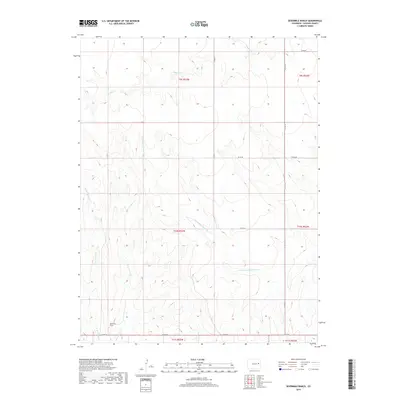
2019 Map of Sevenmile Ranch
USGS Topo · Published 2019About this map
S Fork Republican River winds through the eastern plains of Lincoln County, defining the drainage patterns of this high-altitude landscape. The namesake Sevenmile Ranch serves as a primary point of human settlement in a region dominated by wide-open grazing land and intermittent watercourses. Several tributaries, including Sevenmile Cr, W Sevenmile Cr, and Buffalo Cr, carve shallow valleys across the terrain, illustrating the hydrologic network that supports ranching operations in this part of Colorado. A grid of county roads, such as Co RD 41 and Co RD 2w, provides the only overland access between the isolated ranch sites and the state highway system. The map documents a landscape where land use is dictated by the availability of water, centered around the seasonal flow of Coon Cr and its neighboring streams.
Find a feature on this map
18 named features on this map. Tap any name to fly to it.
Don’t see what you’re looking for? This feature index may not catch every label — zoom into the map to look around manually.
Map Details
Editions of this 2019 Sevenmile Ranch Map
This is the sole edition of this map. No revisions or reprints were ever made.
Other maps of this area

1954 · Limon
USGS Topo · 1:250,000

1957 · Limon
USGS Topo · 1:250,000

1958 · Limon
USGS Topo · 1:250,000

1978 · Clifford
USGS Topo · 1:24,000

1978 · Hugo 4 NW
USGS Topo · 1:24,000

1979 · Sevenmile Ranch
USGS Topo · 1:24,000
1979 · Clifford
USGS Topo · 1:24,000

1979 · Arriba
USGS Topo · 1:24,000

1979 · Flagler SW
USGS Topo · 1:24,000

1979 · Genoa East
USGS Topo · 1:24,000