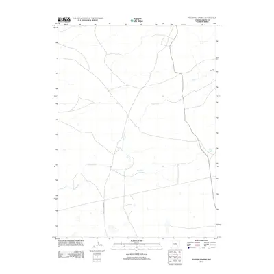
2012 Map of Sevenmile Spring
USGS Topo · Published 2012About this map
Sevenmile Spring and the surrounding high plains of Albany County are defined by a sparse but vital network of water sources and historic transit routes. This 2012 survey highlights the importance of seasonal hydrology in the high desert, with Sevenmile Cr and Spring Cr winding through the landscape. The most significant historical marker is the Old Fort Fetterman Rd, a corridor that once connected the Union Pacific Railroad to military posts in the north. The terrain breaks sharply at Box Canyon in the northeast, while Boswell Spring provides a permanent point of interest for those studying the regional livestock and ranching history that has shaped this part of Wyoming for generations.
Find a feature on this map
6 named features on this map. Tap any name to fly to it.
Don’t see what you’re looking for? This feature index may not catch every label — zoom into the map to look around manually.
Map Details
Editions of this 2012 Sevenmile Spring Map
This is the sole edition of this map. No revisions or reprints were ever made.
Other maps of this area

1954 · Torrington
USGS Topo · 1:250,000

1954 · Cheyenne
USGS Topo · 1:250,000

1955 · Pine Tree Ridge
USGS Topo · 1:24,000

1955 · Mc Gill Lakes
USGS Topo · 1:24,000

1955 · Sevenmile Spring
USGS Topo · 1:24,000

1955 · Ayres Spring
USGS Topo · 1:24,000

1955 · Cannonball Cut
USGS Topo · 1:24,000

1955 · Wilcox
USGS Topo · 1:24,000

1958 · Cheyenne
USGS Topo · 1:250,000

1958 · Torrington
USGS Topo · 1:250,000