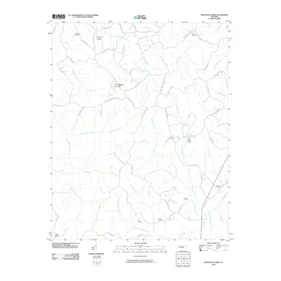
2010 Map of Seventeen Creek
USGS Topo · Published 2010About this map
Pleasant Hill serves as a central landmark in this rural landscape of Carroll County, where the terrain is intricately carved by numerous tributaries flowing toward the Big Sandy River. The map reveals a deeply rooted community structure, evidenced by the high density of small family or local burial grounds such as Friendship Cemetery, Nowell Cemetery, and Palestine Cemetery. The importance of water management and local recreation is visible through the presence of the Cotton Creek Hunting Club Dam and the Lester Jackson Dam, which forms Lester Jackson Lake.
Find a feature on this map
69 named features on this map. Tap any name to fly to it.
Don’t see what you’re looking for? This feature index may not catch every label — zoom into the map to look around manually.
Map Details
Editions of this 2010 Seventeen Creek Map
This is the sole edition of this map. No revisions or reprints were ever made.
Other maps of this area

1936 · Yuma
USGS Topo · 1:24,000

1936 · Camden
USGS Topo · 1:24,000

1936 · Seventeen Creek
USGS Topo · 1:24,000

1936 · Vale
USGS Topo · 1:24,000

1936 · Bruceton
USGS Topo · 1:24,000

1936 · Sugar Tree
USGS Topo · 1:24,000

1936 · Cavvia
USGS Topo · 1:24,000

1936 · Buena Vista
USGS Topo · 1:24,000

1936 · Rockport
USGS Topo · 1:24,000
1949 · Sugar Tree
USGS Topo · 1:24,000