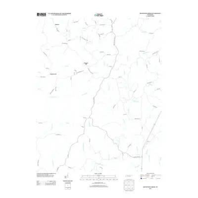
2013 Map of Seventeen Creek
USGS Topo · Published 2013About this map
Pleasant Hill and Pond Branch anchor a rural landscape in Carroll County defined by the complex drainage systems of the Tennessee River watershed. The geography is characterized by an intricate network of waterways, including the winding Seventeen Cr, Fourteen Cr, and W Fork Birdsong Cr, which carve through the terrain. Evidence of the region’s long-standing overland transit history is visible in the presence of the Old Natchez Trace Trl and the Divider and Natchez Trace Rd, tracing routes that have served travelers for generations.
Find a feature on this map
81 named features on this map. Tap any name to fly to it.
Don’t see what you’re looking for? This feature index may not catch every label — zoom into the map to look around manually.
Map Details
Editions of this 2013 Seventeen Creek Map
This is the sole edition of this map. No revisions or reprints were ever made.
Other maps of this area

1936 · Yuma
USGS Topo · 1:24,000

1936 · Camden
USGS Topo · 1:24,000

1936 · Seventeen Creek
USGS Topo · 1:24,000

1936 · Vale
USGS Topo · 1:24,000

1936 · Bruceton
USGS Topo · 1:24,000

1936 · Sugar Tree
USGS Topo · 1:24,000

1936 · Cavvia
USGS Topo · 1:24,000

1936 · Buena Vista
USGS Topo · 1:24,000

1936 · Rockport
USGS Topo · 1:24,000
1949 · Sugar Tree
USGS Topo · 1:24,000