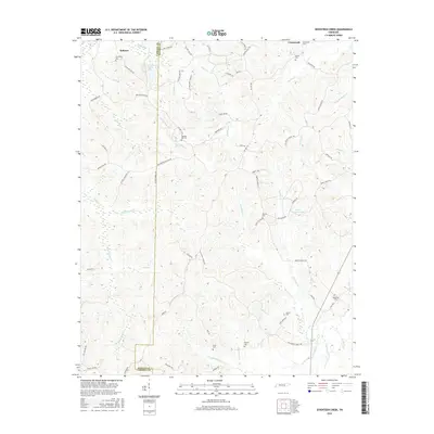
2016 Map of Seventeen Creek
USGS Topo · Published 2016About this map
The boundary between Carroll and Benton Counties defines this rural Tennessee landscape, where small communities like Robison and Crossroads are connected by a network of named country roads and family-linked trails. The area is heavily intersected by a complex drainage system, most notably Seventeen Creek and Fourteen Creek, alongside numerous branches and forks such as East Fork Blunt Creek and West Fork Birdsong Creek. Local heritage is anchored by a significant number of cemeteries, including Friendship Cemetery and Pleasant Hill Cemetery, suggesting a long-standing pattern of family settlements. Notable recreational and historical landmarks include the Cotton Creek Hunting Club Lake in the north and a portion of the Old Natchez Trace Trl, providing a clear record of the region's transport and social history.
Find a feature on this map
81 named features on this map. Tap any name to fly to it.
Don’t see what you’re looking for? This feature index may not catch every label — zoom into the map to look around manually.
Map Details
Editions of this 2016 Seventeen Creek Map
This is the sole edition of this map. No revisions or reprints were ever made.
Other maps of this area

1936 · Yuma
USGS Topo · 1:24,000

1936 · Camden
USGS Topo · 1:24,000

1936 · Seventeen Creek
USGS Topo · 1:24,000

1936 · Vale
USGS Topo · 1:24,000

1936 · Bruceton
USGS Topo · 1:24,000

1936 · Sugar Tree
USGS Topo · 1:24,000

1936 · Cavvia
USGS Topo · 1:24,000

1936 · Buena Vista
USGS Topo · 1:24,000

1936 · Rockport
USGS Topo · 1:24,000
1949 · Sugar Tree
USGS Topo · 1:24,000