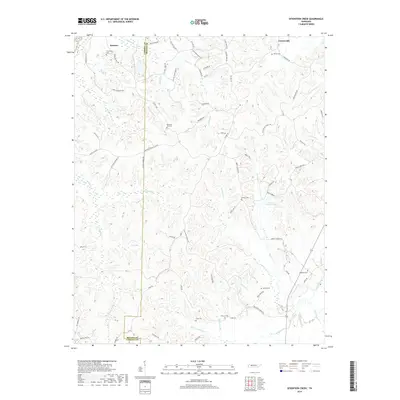
2019 Map of Seventeen Creek
USGS Topo · Published 2019About this map
The boundary between Carroll and Benton Counties defines the central axis of this landscape, where small rural communities like Robison and Crossroads persist in a network of winding creek valleys. The drainage system is particularly dense, with Seventeen Creek, Fourteen Creek, and the various forks of Blunt Creek carving the terrain into a series of ridges and hollows. This geography shaped the early settlement patterns of the area, as evidenced by the high concentration of family and community burial grounds, such as Ellis Cemetery, Friendship Cemetery, and Pleasant Hill Cemetery.
Find a feature on this map
85 named features on this map. Tap any name to fly to it.
Don’t see what you’re looking for? This feature index may not catch every label — zoom into the map to look around manually.
Map Details
Editions of this 2019 Seventeen Creek Map
This is the sole edition of this map. No revisions or reprints were ever made.
Other maps of this area

1936 · Yuma
USGS Topo · 1:24,000

1936 · Camden
USGS Topo · 1:24,000

1936 · Seventeen Creek
USGS Topo · 1:24,000

1936 · Vale
USGS Topo · 1:24,000

1936 · Bruceton
USGS Topo · 1:24,000

1936 · Sugar Tree
USGS Topo · 1:24,000

1936 · Cavvia
USGS Topo · 1:24,000

1936 · Buena Vista
USGS Topo · 1:24,000

1936 · Rockport
USGS Topo · 1:24,000
1949 · Sugar Tree
USGS Topo · 1:24,000