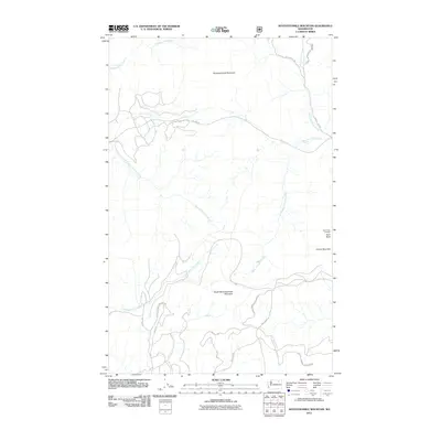
2011 Map of Seventeenmile Mountain
USGS Topo · Published 2011About this map
Colville Indian Reservation lands dominate the southern half of this landscape, where the terrain is defined by the high peaks of Seventeenmile Mountain and South Seventeenmile Mountain. The drainage network is complex, with Seventeenmile Creek and Twentyone Mile Creek cutting through the western slopes while the eastern portion is shaped by the headwaters of Hall Creek and its major tributaries, North Fork Hall Creek and West Fork Hall Creek. A distinct human imprint is visible through the Bureau of Indian Affairs road system, including BIA 1050 Rd and BIA 14 Rd, which navigate the steep topography. Near the eastern boundary, Paint Rock Lookout stands as a prominent vantage point on Paint Rock, overlooking the ridge lines near Grizzly Mountain. This 2011 survey captures a remote section of Ferry County where forestry and traditional land use intersect with high-altitude landmarks.
Find a feature on this map
19 named features on this map. Tap any name to fly to it.
Don’t see what you’re looking for? This feature index may not catch every label — zoom into the map to look around manually.
Map Details
Editions of this 2011 Seventeenmile Mountain Map
This is the sole edition of this map. No revisions or reprints were ever made.
Other maps of this area

1904 · Republic
USGS Topo · 1:125,000

1936 · Marcus
USGS Topo · 1:96,000

1942 · Marcus
USGS Topo · 1:125,000

1948 · Republic
USGS Topo · 1:62,500

1948 · Sherman Peak
USGS Topo · 1:62,500

1951 · Sherman Peak
USGS Topo · 1:62,500

1951 · Republic
USGS Topo · 1:62,500

1952 · Twin Lakes
USGS Topo · 1:62,500

1953 · Seventeenmile Mtn.
USGS Topo · 1:62,500

1954 · Okanogan
USGS Topo · 1:250,000