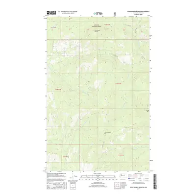
2017 Map of Seventeenmile Mountain
USGS Topo · Published 2017About this map
Colville National Forest dominates this section of Ferry County, where the high peaks of Seventeenmile Mountain and S Seventeenmile Mtn define the watershed. A complex network of drainage basins feeds into the Sanpoil and Kettle River systems, with Seventeenmile Cr and Twentyone Mile Cr carving through the steep topography. Further east, the headwaters of the Hall Creek system appear, including N Fork Hall Cr and W Fork Hall Cr. The map captures a landscape largely managed for forestry and conservation, as evidenced by the system of Forest Service and Bureau of Indian Affairs routes like BIA Rd 1050 and Seventeenmile Rd. This 2017 survey reflects the modern management of these timberlands, showing the distinct boundary markers between townships like t34n r33e and t34n r34e. Notable landmarks such as Paint Rock and Grizzly Mtn serve as vital navigation points for those traversing the Grizzly Trl.
Find a feature on this map
27 named features on this map. Tap any name to fly to it.
Don’t see what you’re looking for? This feature index may not catch every label — zoom into the map to look around manually.
Map Details
Editions of this 2017 Seventeenmile Mountain Map
This is the sole edition of this map. No revisions or reprints were ever made.
Other maps of this area

1904 · Republic
USGS Topo · 1:125,000

1936 · Marcus
USGS Topo · 1:96,000

1942 · Marcus
USGS Topo · 1:125,000

1948 · Republic
USGS Topo · 1:62,500

1948 · Sherman Peak
USGS Topo · 1:62,500

1951 · Sherman Peak
USGS Topo · 1:62,500

1951 · Republic
USGS Topo · 1:62,500

1952 · Twin Lakes
USGS Topo · 1:62,500

1953 · Seventeenmile Mtn.
USGS Topo · 1:62,500

1954 · Okanogan
USGS Topo · 1:250,000