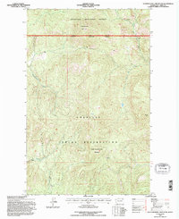
1992 Map of Seventeenmile Mountain
USGS Topo · Published 1996About this map
High-altitude terrain and tribal boundaries define this portion of Ferry County, where the Colville National Forest meets the northern edge of the Colville Indian Reservation. The map is anchored by the prominent peaks of Seventeenmile Mountain and South Seventeenmile Mountain, with the distinctive summit of Grizzly Mtn rising to the east. A network of drainages including Seventeenmile Creek and the West Fork Hall Creek carve through the landscape, illustrating the complex watershed management shared between federal and tribal authorities. The administrative National Forest Boundary Indian Reservation Boundary is a central feature, marking a significant transition in land use and jurisdiction during the early 1990s.
Find a feature on this map
10 named features on this map. Tap any name to fly to it.
Don’t see what you’re looking for? This feature index may not catch every label — zoom into the map to look around manually.
Map Details
Editions of this 1992 Seventeenmile Mountain Map
This is the sole edition of this map. No revisions or reprints were ever made.
Other maps of this area

1904 · Republic
USGS Topo · 1:125,000

1936 · Marcus
USGS Topo · 1:96,000

1942 · Marcus
USGS Topo · 1:125,000

1948 · Republic
USGS Topo · 1:62,500

1948 · Sherman Peak
USGS Topo · 1:62,500

1951 · Sherman Peak
USGS Topo · 1:62,500

1951 · Republic
USGS Topo · 1:62,500

1952 · Twin Lakes
USGS Topo · 1:62,500

1953 · Seventeenmile Mtn.
USGS Topo · 1:62,500

1954 · Okanogan
USGS Topo · 1:250,000