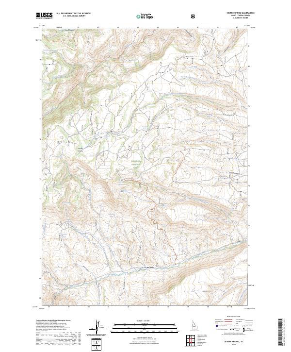
2024 Map of Severe Spring
USGS Topo · Published 2024About this map
Sawtooth National Forest dominates this section of Cassia County, where a complex network of high-elevation drainages and natural springs defines the landscape. The geography is characterized by prominent divides such as Cottonwood Ridge and Hudson Ridge, which separate various branches of the local water system. High-country meadows like Durfee Meadow provide localized points of reference amidst a web of canyons, including Cave Canyon and Walker Hollow.
Find a feature on this map
49 named features on this map. Tap any name to fly to it.
Don’t see what you’re looking for? This feature index may not catch every label — zoom into the map to look around manually.
Map Details
Editions of this 2024 Severe Spring Map
This is the sole edition of this map. No revisions or reprints were ever made.
Other maps of this area

1954 · Pocatello
USGS Topo · 1:250,000

1955 · Twin Falls
USGS Topo · 1:250,000

1958 · Twin Falls
USGS Topo · 1:250,000

1958 · Pocatello
USGS Topo · 1:250,000

1965 · Rams Horn Ridge
USGS Topo · 1:24,000

1965 · Buckhorn Canyon
USGS Topo · 1:24,000
1968 · Blue Hill
USGS Topo · 1:24,000
1968 · Oakley
USGS Topo · 1:24,000
1968 · Marion
USGS Topo · 1:24,000

1977 · Mahogany Butte
USGS Topo · 1:24,000