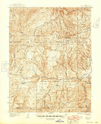
1935 Map of Sevier
USGS Topo · Published 1949About this map
The high-elevation terrain of the Pavant and Tushar ranges dominates this 1930s survey, where steep drainages like Clear Creek Canyon and Corn Creek carve through the landscape. The small settlement of Sevier sits at the eastern edge of the sheet, serving as a hub for the Denver and Rio Grande Western RR along the river. This era of land management is clearly visible through a network of isolated outposts, including the Pavant Ranger Sta, Rockwood Ranger Sta, and Belknap Ranger Sta, which provided oversight for the surrounding timber and grazing lands.
Find a feature on this map
107 named features on this map. Tap any name to fly to it.
Don’t see what you’re looking for? This feature index may not catch every label — zoom into the map to look around manually.
Map Details
Editions of this 1935 Sevier Map
3 editions found
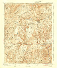
Other maps of this area

1885 · Beaver
USGS Topo · 1:250,000

1932 · Sevier
USGS Topo · 1:62,500

1935 · Sevier
USGS Topo · 1:62,500

1937 · Delano Peak
USGS Topo · 1:48,000

1940 · Monroe
USGS Topo · 1:62,500

1943 · Delano Peak
USGS Topo · 1:62,500

1944 · Monroe
USGS Topo · 1:62,500

1945 · Marysvale
USGS Topo · 1:62,500

1947 · Marysvale
USGS Topo · 1:62,500

1953 · Richfield
USGS Topo · 1:250,000