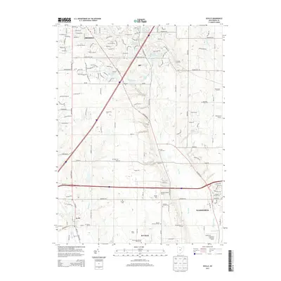
2013 Map of Seville
USGS Topo · Published 2013About this map
The Styx River and West Br Rocky River valley systems define this portion of Medina County, where agricultural lands and scattered timber operations meet the expanding suburban fringes of Medina and Wadsworth. The landscape is notably punctuated by numerous small cemeteries and timber resources, including the Chronister Tree Farm, White House Tree Farm, and Paradise Tree Farm. These features, alongside the Hillcrest Memorial Gardens, point to a region with deep-rooted community history and a persistent connection to the land. Aviation is also prominent in the area, with the Weltzien Skypark Airport and Wadsworth Municipal Airport serving the local aviation community.
Find a feature on this map
75 named features on this map. Tap any name to fly to it.
Don’t see what you’re looking for? This feature index may not catch every label — zoom into the map to look around manually.
Map Details
Editions of this 2013 Seville Map
This is the sole edition of this map. No revisions or reprints were ever made.
Other maps of this area

1901 · Massillon
USGS Topo · 1:62,500

1901 · Wooster
USGS Topo · 1:62,500

1903 · Massillon
USGS Topo · 1:62,500

1903 · Wooster
USGS Topo · 1:62,500

1903 · Akron
USGS Topo · 1:62,500

1904 · Medina
USGS Topo · 1:62,500

1905 · Akron
USGS Topo · 1:62,500

1906 · Medina
USGS Topo · 1:62,500

1950 · Cleveland
USGS Topo · 1:250,000

1951 · Canton
USGS Topo · 1:250,000