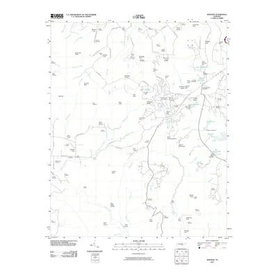
2010 Map of Sewanee
USGS Topo · Published 2010About this map
The University of the South anchors the central plateau on this 2010 survey of the Cumberland region, surrounded by a complex landscape of coves, hollows, and historic settlements. The presence of the Sewanee Post Office and Saint Andrews Post Office highlights the established community hubs, while numerous family and institutional burial grounds like University Cemetery and Sewell-Bowers Cemetery provide deep roots for genealogical research. The terrain is marked by industrial and natural landmarks, from the Shakerag Hollow Mine and Kelley Mine to dramatic points such as Morgans Steep and Point Disappointment. Water features like Lake Cheston and the Boiling Fork Creek network define the local geography. Beneath the plateau, the Cowan Tunnel indicates the important railroad engineering required to traverse this section of Franklin County.
Find a feature on this map
149 named features on this map. Tap any name to fly to it.
Don’t see what you’re looking for? This feature index may not catch every label — zoom into the map to look around manually.
Map Details
Editions of this 2010 Sewanee Map
This is the sole edition of this map. No revisions or reprints were ever made.
Other maps of this area

1895 · Sewanee
USGS Topo · 1:125,000

1928 · Decherd
USGS Topo · 1:62,500

1936 · Sewanee
USGS Topo · 1:24,000

1936 · Alto
USGS Topo · 1:24,000

1936 · Orme
USGS Topo · 1:24,000

1936 · Sinking Cove
USGS Topo · 1:24,000

1936 · Burrow Cove
USGS Topo · 1:24,000

1936 · Monteagle
USGS Topo · 1:24,000

1936 · Winchester
USGS Topo · 1:24,000

1936 · Pitcher Ridge
USGS Topo · 1:24,000