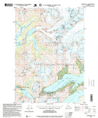
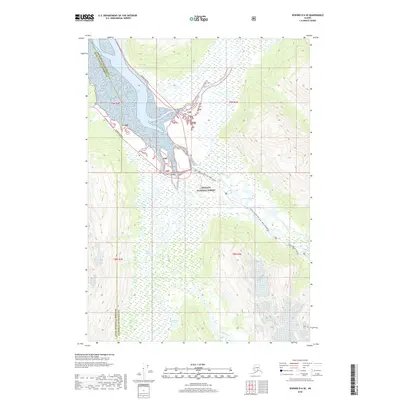
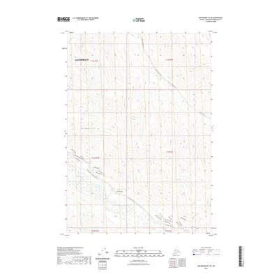
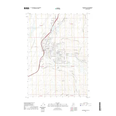
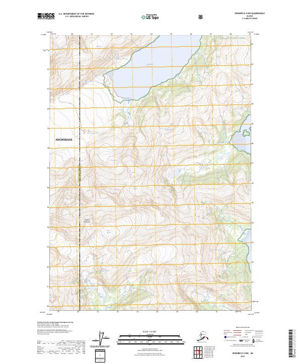
1995 Map of Seward D-5
USGS Topo · Published 1999About this map
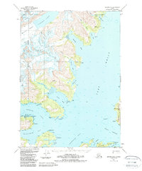
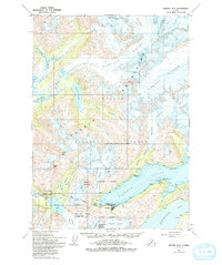
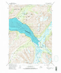
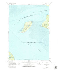
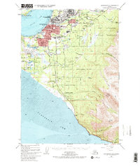
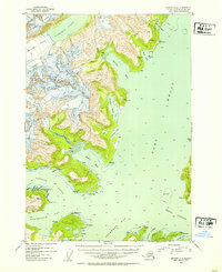
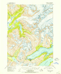
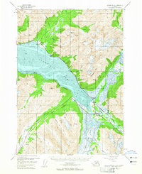
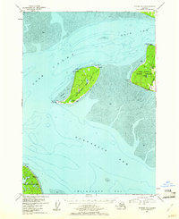
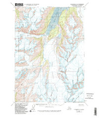
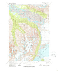
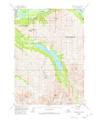
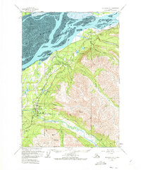
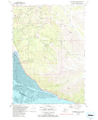
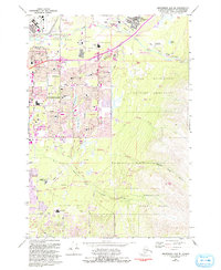
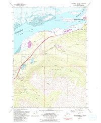
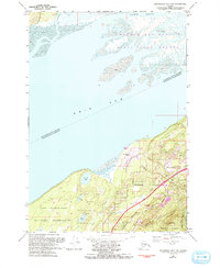
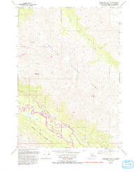
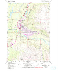
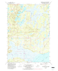
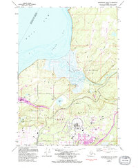
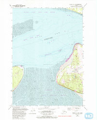
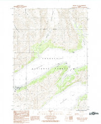
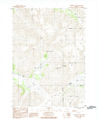
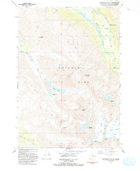
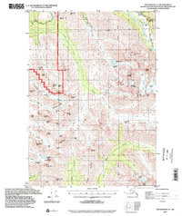
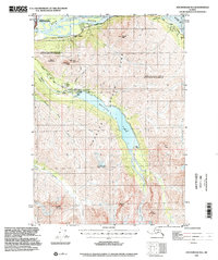
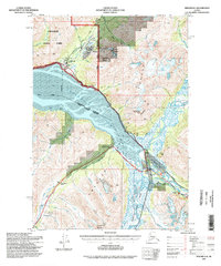
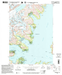
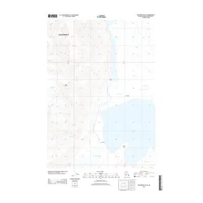
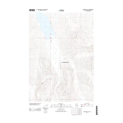
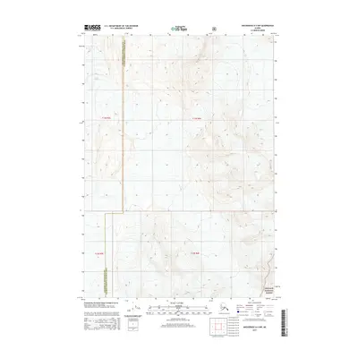
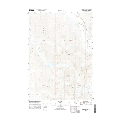
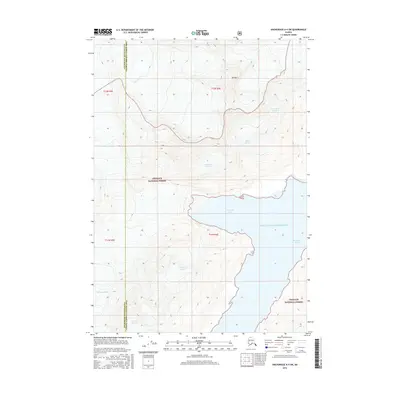
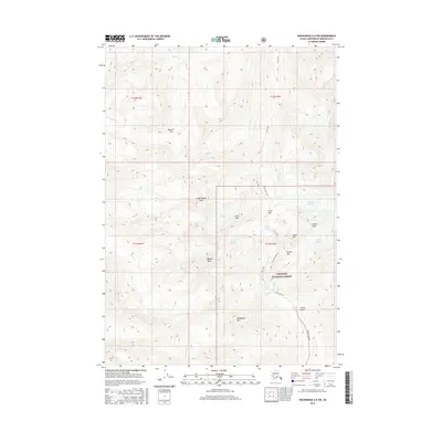
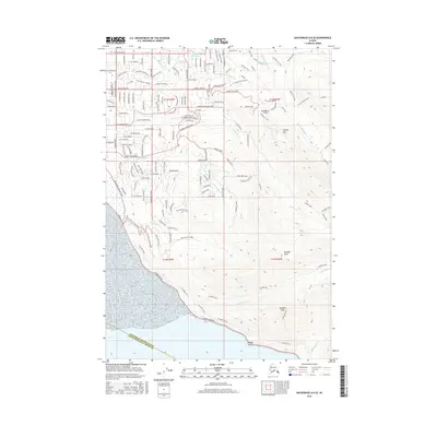
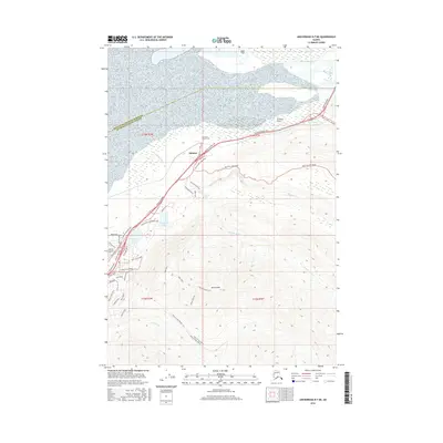
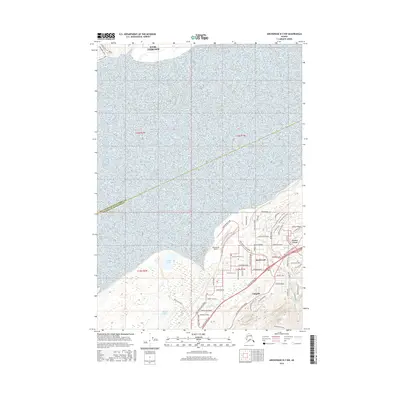
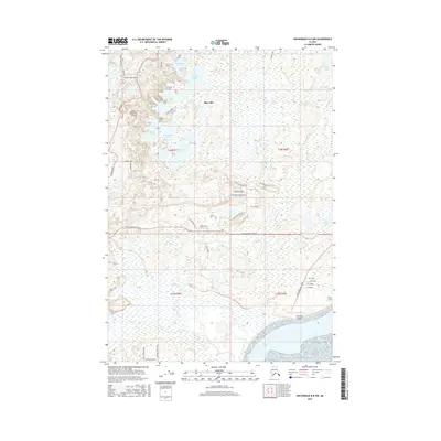
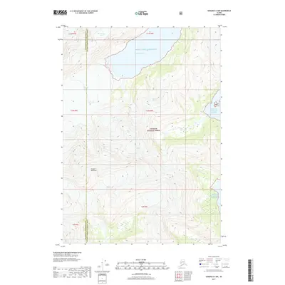
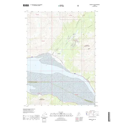
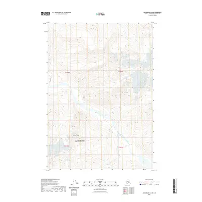
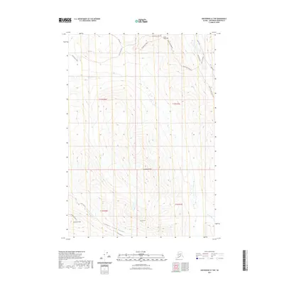
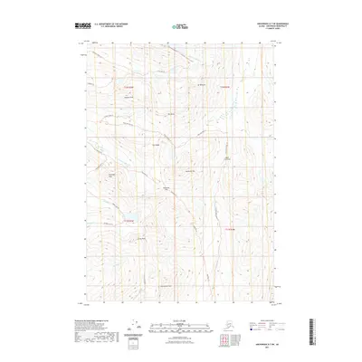
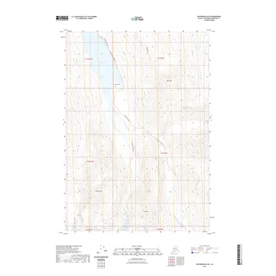
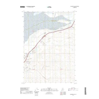
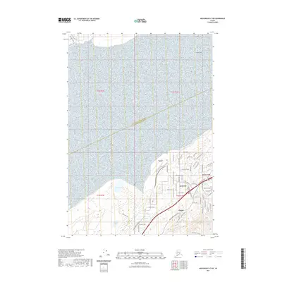
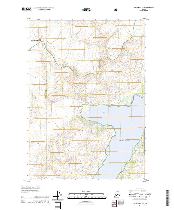
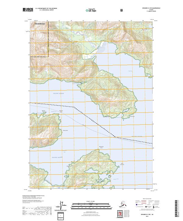
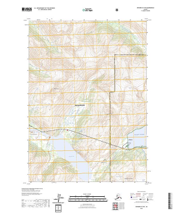
Whittier serves as the focal point of this Chugach mountain landscape, positioned along the shores of Passage Canal where the rail Tunnel provides a vital link through the granite peaks. This 1995 revision reveals a transition from industrial and military utility to recreational use, evidenced by the Begich Boggs Visitor Center and the Byron Glacier Trail. The map details a complex glacial environment where the Portage Glacier and Harriman Glacier dominate the high country, feeding into the Twentymile River and Placer River systems. Local industrial history is noted by the presence of the Portage Mine and Oil Tanks near the coastline. Coastal features like Shotgun Cove and Emerald Bay define the shoreline of Whittier Bay, illustrating the area's dual character as a deep-water port and a gateway to the Alaskan wilderness.
Find a feature on this map
48 named features on this map. Tap any name to fly to it.
Don’t see what you’re looking for? This feature index may not catch every label — zoom into the map to look around manually.
Map Details
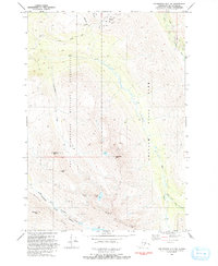
Editions of this 1995 Seward D-5 Map
This is the sole edition of this map. No revisions or reprints were ever made.
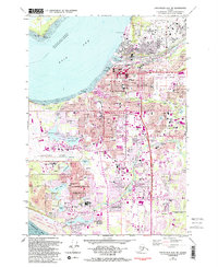
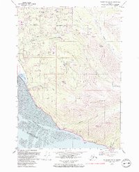
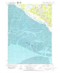
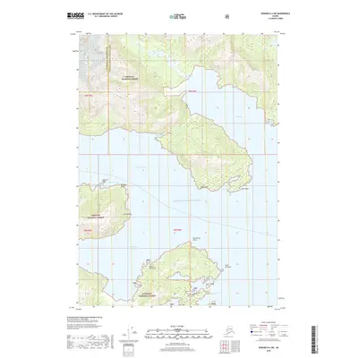
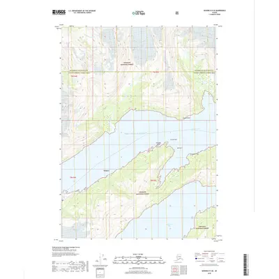
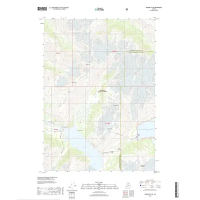
Historical Maps of Whittier Through Time
141 maps found
1951 Seward D-4
Anchorage Borough, AK
1951 Seward D-5
Anchorage Borough, AK
1951 Seward D-6
Anchorage Borough, AK
1951 Tyonek A-1
Anchorage Borough, AK
1952 Anchorage A-8
Anchorage Borough, AK
1952 Seward D-4
Anchorage Borough, AK
1952 Seward D-5
Anchorage Borough, AK
1952 Seward D-6
Anchorage Borough, AK
1952 Tyonek A-1
Anchorage Borough, AK
1953 Anchorage A-8
Anchorage Borough, AK
1960 Anchorage A-4
Anchorage Borough, AK
1960 Anchorage A-5
Anchorage Borough, AK
1960 Anchorage A-6
Anchorage Borough, AK
1960 Anchorage A-7
Anchorage Borough, AK
1960 Anchorage B-4
Anchorage Borough, AK
1960 Anchorage B-5
Anchorage Borough, AK
1960 Anchorage B-6
Anchorage Borough, AK
1960 Anchorage B-7
Anchorage Borough, AK
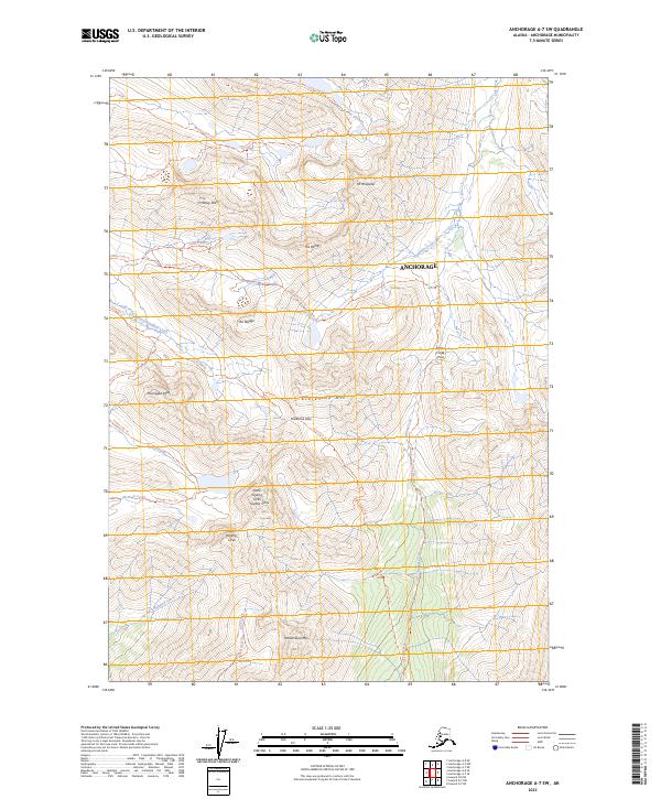
1979 Anchorage A-7 NE
Anchorage Borough, AK
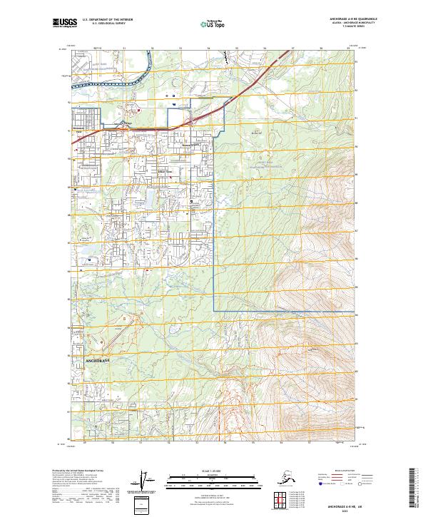
1979 Anchorage A-8 NE
Anchorage Borough, AK
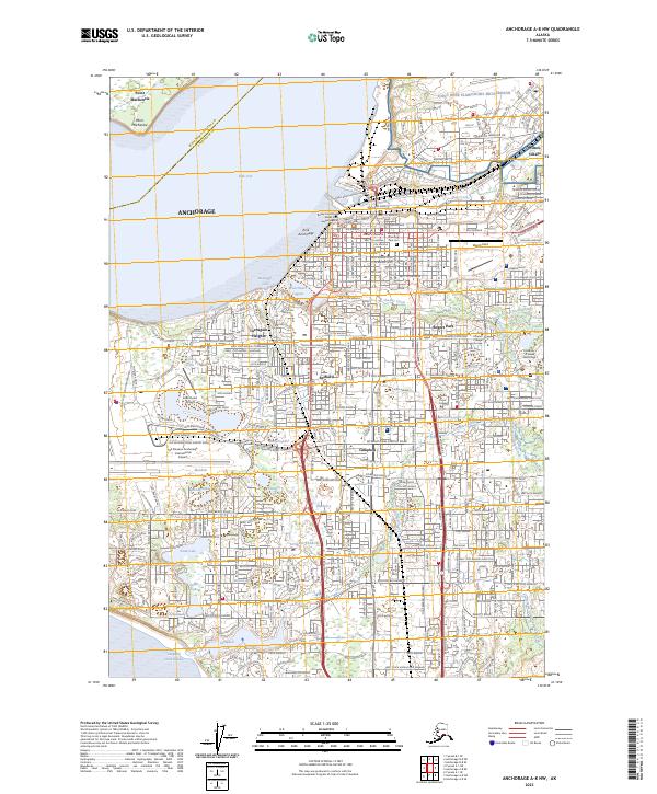
1979 Anchorage A-8 NW
Anchorage Borough, AK
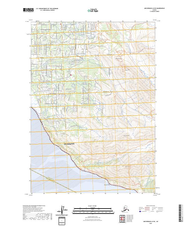
1979 Anchorage A-8 SE
Anchorage Borough, AK
1979 Anchorage A-8 SW
Anchorage Borough, AK
1979 Anchorage B-7 NE
Anchorage Borough, AK
1979 Anchorage B-7 NW
Anchorage Borough, AK
1979 Anchorage B-7 SE
Anchorage Borough, AK
1979 Anchorage B-7 SW
Anchorage Borough, AK
1979 Anchorage B-8 NW
Anchorage Borough, AK
1979 Anchorage B-8 SE
Anchorage Borough, AK
1979 Tyonek A-1 NE
Anchorage Borough, AK
1984 Seward D-5 SE
Anchorage Borough, AK
1984 Seward D-5 SW
Anchorage Borough, AK
1984 Seward D-6 NE
Anchorage Borough, AK
1984 Seward D-6 Nw
Anchorage Borough, AK
1984 Seward D-6 SE
Anchorage Borough, AK
1993 Anchorage A-7 NE
Anchorage Borough, AK
1993 Anchorage A-7 NW
Anchorage Borough, AK
1993 Anchorage A-8 SW
Anchorage Borough, AK
1994 Anchorage A-6
Anchorage Borough, AK
1994 Anchorage A-7
Anchorage Borough, AK
1994 Anchorage A-8
Anchorage Borough, AK
1994 Anchorage B-4
Anchorage Borough, AK
1994 Anchorage B-5
Anchorage Borough, AK
1994 Anchorage B-6
Anchorage Borough, AK

1994 Anchorage B-7
Anchorage Borough, AK
1994 Seward D-6
Anchorage Borough, AK
1995 Seward D-4
Anchorage Borough, AK
1995 Seward D-5
Anchorage Borough, AK
2013 Anchorage B-4 SW
Anchorage Borough, AK
2013 Anchorage B-5 SE
Anchorage Borough, AK

2013 Anchorage B-5 SW
Anchorage Borough, AK
2013 Anchorage B-6 SE
Anchorage Borough, AK
2013 Anchorage B-6 SW
Anchorage Borough, AK
2013 Anchorage B-7 SE
Anchorage Borough, AK
2015 Anchorage A-4 NW
Anchorage Borough, AK
2015 Anchorage A-5 NE
Anchorage Borough, AK

2015 Anchorage A-5 NW
Anchorage Borough, AK
2015 Anchorage A-6 NE
Anchorage Borough, AK
2015 Anchorage A-6 NW
Anchorage Borough, AK
2015 Anchorage A-7 NE
Anchorage Borough, AK

2015 Anchorage A-7 NW
Anchorage Borough, AK
2015 Anchorage A-8 NE
Anchorage Borough, AK
2015 Anchorage B-7 SW
Anchorage Borough, AK
2015 Anchorage B-8 SE
Anchorage Borough, AK
2016 Anchorage A-4 SW
Anchorage Borough, AK
2016 Anchorage A-5 SE
Anchorage Borough, AK
2016 Anchorage A-5 SW
Anchorage Borough, AK
2016 Anchorage A-6 SE
Anchorage Borough, AK
2016 Anchorage A-6 SW
Anchorage Borough, AK
2016 Anchorage A-7 SE
Anchorage Borough, AK
2016 Anchorage A-7 SW
Anchorage Borough, AK
2016 Anchorage A-8 NW
Anchorage Borough, AK
2016 Anchorage A-8 SE
Anchorage Borough, AK
2016 Anchorage B-7 NE
Anchorage Borough, AK
2016 Anchorage B-7 NW
Anchorage Borough, AK
2016 Anchorage B-8 NW
Anchorage Borough, AK
2017 Seward D-4 NW
Anchorage Borough, AK
2017 Seward D-5 NE
Anchorage Borough, AK
2017 Seward D-5 NW
Anchorage Borough, AK
2017 Seward D-6 NE
Anchorage Borough, AK
2017 Seward D-6 NW
Anchorage Borough, AK
2018 Seward D-4 SW
Anchorage Borough, AK
2018 Seward D-5 SE
Anchorage Borough, AK
2018 Seward D-5 SW
Anchorage Borough, AK
2018 Seward D-6 SE
Anchorage Borough, AK
2019 Anchorage A-8 NW
Anchorage Borough, AK
2019 Anchorage A-8 SW
Anchorage Borough, AK
2019 Tyonek A-1 NE
Anchorage Borough, AK
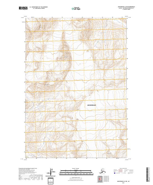
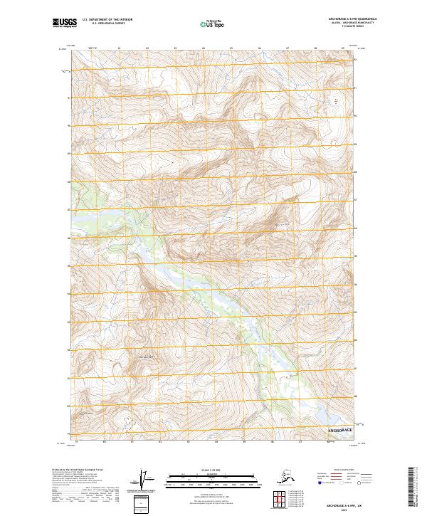
2021 Anchorage A-6 NW
Anchorage Borough, AK
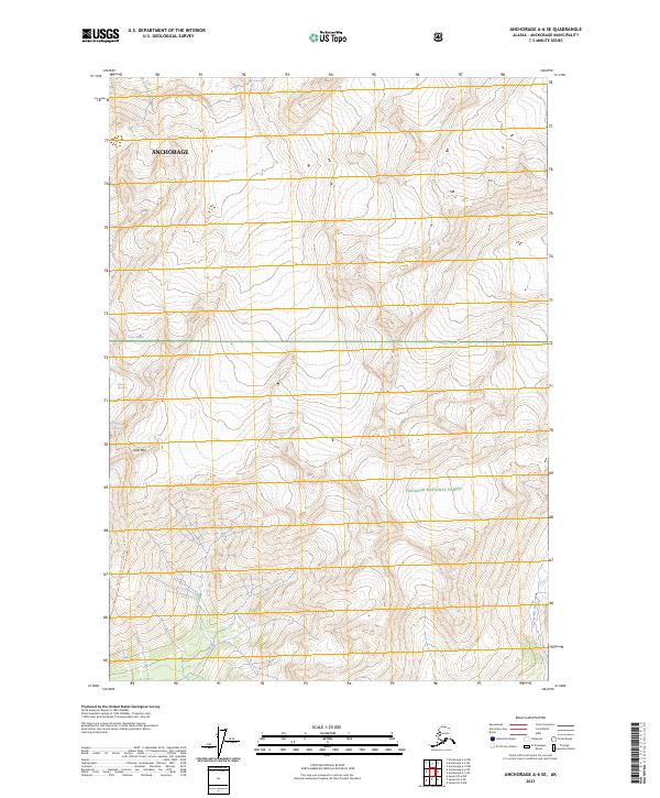
2021 Anchorage A-6 SE
Anchorage Borough, AK
2021 Anchorage A-6 SW
Anchorage Borough, AK
2021 Anchorage A-7 NE
Anchorage Borough, AK
2021 Anchorage A-7 NW
Anchorage Borough, AK
2021 Anchorage A-7 SW
Anchorage Borough, AK
2021 Anchorage A-8 NE
Anchorage Borough, AK
2021 Anchorage A-8 SE
Anchorage Borough, AK
2021 Anchorage A-8 SW
Anchorage Borough, AK
2021 Anchorage B-6 SE
Anchorage Borough, AK
2021 Anchorage B-7 NE
Anchorage Borough, AK
2021 Anchorage B-7 NW
Anchorage Borough, AK
2021 Anchorage B-7 SE
Anchorage Borough, AK
2021 Anchorage B-7 SW
Anchorage Borough, AK
2021 Anchorage B-8 SE
Anchorage Borough, AK
2023 Anchorage A-4 NW
Anchorage Borough, AK
2023 Anchorage A-4 SW
Anchorage Borough, AK
2023 Anchorage A-5 NE
Anchorage Borough, AK
2023 Anchorage A-5 NW
Anchorage Borough, AK
2023 Anchorage A-5 SE
Anchorage Borough, AK
2023 Anchorage A-5 SW
Anchorage Borough, AK
2023 Anchorage A-6 NE
Anchorage Borough, AK
2023 Anchorage A-6 NW
Anchorage Borough, AK
2023 Anchorage A-6 SE
Anchorage Borough, AK
2023 Anchorage A-6 SW
Anchorage Borough, AK
2023 Anchorage A-7 NE
Anchorage Borough, AK
2023 Anchorage A-7 NW
Anchorage Borough, AK
2023 Anchorage A-7 SE
Anchorage Borough, AK
2023 Anchorage A-7 SW
Anchorage Borough, AK
2023 Anchorage A-8 NE
Anchorage Borough, AK
2023 Anchorage A-8 NW
Anchorage Borough, AK
2023 Anchorage A-8 SE
Anchorage Borough, AK
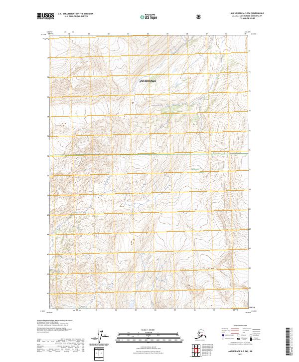
2023 Anchorage B-4 SW
Anchorage Borough, AK
2023 Anchorage B-5 SE
Anchorage Borough, AK
2023 Anchorage B-5 SW
Anchorage Borough, AK
2023 Anchorage B-6 SE
Anchorage Borough, AK
2023 Anchorage B-6 SW
Anchorage Borough, AK
2023 Anchorage B-7 NE
Anchorage Borough, AK
2023 Anchorage B-7 NW
Anchorage Borough, AK
2023 Anchorage B-7 SE
Anchorage Borough, AK
2023 Anchorage B-7 SW
Anchorage Borough, AK
2023 Anchorage B-8 NW
Anchorage Borough, AK
2023 Anchorage B-8 SE
Anchorage Borough, AK
2023 Seward D-4 NW
Anchorage Borough, AK
2023 Seward D-4 SW
Anchorage Borough, AK
2023 Seward D-5 NE
Anchorage Borough, AK
2023 Seward D-5 NW
Anchorage Borough, AK
2023 Seward D-5 SE
Anchorage Borough, AK
2023 Seward D-5 SW
Anchorage Borough, AK
2023 Seward D-6 NE
Anchorage Borough, AK
2023 Seward D-6 NW
Anchorage Borough, AK
2023 Seward D-6 SE
Anchorage Borough, AK
2023 Tyonek A-1 NE
Anchorage Borough, AK