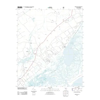
2011 Map of Sewee Bay
USGS Topo · Published 2011About this map
Wappetow Cemetery stands as a significant historical anchor in this coastal landscape, situated near the headwaters of the Wando River. The settlement pattern follows a distinct transition from the agricultural interior, where small communities like Woodville and Chandler are established along the road network, to the intricate tidal marshes of the Atlantic coast. The Intracoastal Waterway cuts through these wetlands, bypassing Sewee Bay and Mark Bay to support maritime traffic. Land use in the early 21st century reflects a mix of traditional Lowcountry estates and modern rural developments, evidenced by the Santo Sotille Ranch and the proximity of the Awendaw Post Office. The drainage systems of Guerin Creek and Capers Creek illustrate the complex hydrology that has shaped the region's geography and history.
Find a feature on this map
48 named features on this map. Tap any name to fly to it.
Don’t see what you’re looking for? This feature index may not catch every label — zoom into the map to look around manually.
Map Details
Editions of this 2011 Sewee Bay Map
This is the sole edition of this map. No revisions or reprints were ever made.
Other maps of this area

1919 · Capers Island
USGS Topo · 1:21,120

1919 · Wando
USGS Topo · 1:21,120

1919 · Cordesville
USGS Topo · 1:48,000

1919 · Fort Moultrie
USGS Topo · 1:21,120

1919 · Bulls Island
USGS Topo · 1:21,120

1919 · Sewee Bay
USGS Topo · 1:21,120

1943 · Capers Island
USGS Topo · 1:24,000

1943 · Fort Moultrie
USGS Topo · 1:24,000

1943 · Wando
USGS Topo · 1:24,000

1943 · Sewee Bay
USGS Topo · 1:24,000