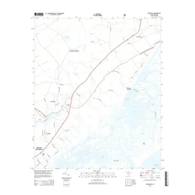
2014 Map of Sewee Bay
USGS Topo · Published 2014About this map
The Francis Marion National Forest dominates the inland landscape, where the northern reaches of Mount Pleasant meet the tidal marshes of the Lowcountry. This coastal environment is defined by the Intracoastal Waterway and the expansive waters of Sewee Bay, separated from the Atlantic by barrier features like Capers Island and Bull Island. Historic settlements such as Awendaw and Woodville are clustered along the N Us 17 corridor, which serves as the primary artery through this region of maritime forests and salt marshes.
Find a feature on this map
55 named features on this map. Tap any name to fly to it.
Don’t see what you’re looking for? This feature index may not catch every label — zoom into the map to look around manually.
Map Details
Editions of this 2014 Sewee Bay Map
This is the sole edition of this map. No revisions or reprints were ever made.
Other maps of this area

1919 · Capers Island
USGS Topo · 1:21,120

1919 · Wando
USGS Topo · 1:21,120

1919 · Cordesville
USGS Topo · 1:48,000

1919 · Fort Moultrie
USGS Topo · 1:21,120

1919 · Bulls Island
USGS Topo · 1:21,120

1919 · Sewee Bay
USGS Topo · 1:21,120

1943 · Capers Island
USGS Topo · 1:24,000

1943 · Fort Moultrie
USGS Topo · 1:24,000

1943 · Wando
USGS Topo · 1:24,000

1943 · Sewee Bay
USGS Topo · 1:24,000