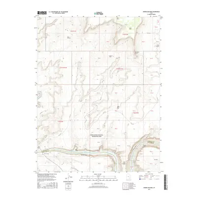
2017 Map of Sewing Machine
USGS Topo · Published 2017About this map
Glen Canyon National Recreation Area dominates this landscape, where the Colorado River and Dirty Devil River converge in a labyrinth of deep canyons and high plateaus. The topography is defined by significant landmarks such as The Sewing Machine and Grainery Rock, reflecting the distinctive geological features of the Colorado Plateau. High above the water, Andy Miller Flats and the Red Benches provide a stark contrast to the dramatic depths of Cataract Canyon and Narrow Canyon. The Flint Trail winds across the terrain, offering a glimpse into the remote access routes used by early travelers and surveyors. Water levels at Lake Powell shape the accessible shoreline near Hite Crossing and the Hite Airport, while historical markers like Freddies Cistern and the winding Mille Crag Bend anchor the map’s most isolated reaches.
Find a feature on this map
29 named features on this map. Tap any name to fly to it.
Don’t see what you’re looking for? This feature index may not catch every label — zoom into the map to look around manually.
Map Details
Editions of this 2017 Sewing Machine Map
This is the sole edition of this map. No revisions or reprints were ever made.
Other maps of this area

1885 · San Rafael
USGS Topo · 1:250,000

1886 · Henry Mountains
USGS Topo · 1:250,000

1892 · Henry Mountains
USGS Topo · 1:250,000

1952 · Mouth of Dark Canyon
USGS Topo · 1:62,500

1952 · Orange Cliffs 3 SW
USGS Topo · 1:24,000

1952 · Hite
USGS Topo · 1:62,500

1953 · Orange Cliffs 3 SE
USGS Topo · 1:24,000

1953 · Orange Cliffs 4 SW
USGS Topo · 1:24,000

1953 · Fiddler Butte
USGS Topo · 1:62,500

1953 · Orange Cliffs
USGS Topo · 1:62,500