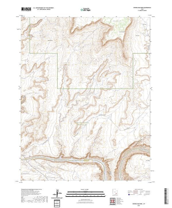
2023 Map of Sewing Machine
USGS Topo · Published 2023About this map
Glen Canyon National Recreation Area dominates this section of the Colorado Plateau, where the Colorado River carves its way through the formidable corridors of Narrow Canyon and Cataract Canyon. The landscape is defined by massive sedimentary formations and high desert mesas, including the prominent Red Benches and The Block. Water management and transportation are central to the area's geography, evidenced by the presence of Lake Powell and the isolated Hite Airport near the Garfield and San Juan county line.
Find a feature on this map
23 named features on this map. Tap any name to fly to it.
Don’t see what you’re looking for? This feature index may not catch every label — zoom into the map to look around manually.
Map Details
Editions of this 2023 Sewing Machine Map
This is the sole edition of this map. No revisions or reprints were ever made.
Other maps of this area

1885 · San Rafael
USGS Topo · 1:250,000

1886 · Henry Mountains
USGS Topo · 1:250,000

1892 · Henry Mountains
USGS Topo · 1:250,000

1952 · Mouth of Dark Canyon
USGS Topo · 1:62,500

1952 · Orange Cliffs 3 SW
USGS Topo · 1:24,000

1952 · Hite
USGS Topo · 1:62,500

1953 · Orange Cliffs 3 SE
USGS Topo · 1:24,000

1953 · Orange Cliffs 4 SW
USGS Topo · 1:24,000

1953 · Fiddler Butte
USGS Topo · 1:62,500

1953 · Orange Cliffs
USGS Topo · 1:62,500